New Orleans' Nine Most Endangered Sites

New Orleans’ 9 Most Endangered Places is Louisiana Landmarks Society’s annual advocacy initiative that spotlights historic sites at risk due to neglect, development pressure, environmental threats, or policy decisions. By elevating these places, the program raises public awareness, mobilizes community support, and advances practical solutions to protect the cultural and architectural heritage that defines New Orleans.

Dr+Alfred+and+Minnie+King+House.webp

2025 New Orleans 9

Code Enforcement Citing “Imminent Dangerous Conditions”

LOCATION: Citywide

THREAT: Demolition by Code Enforcement

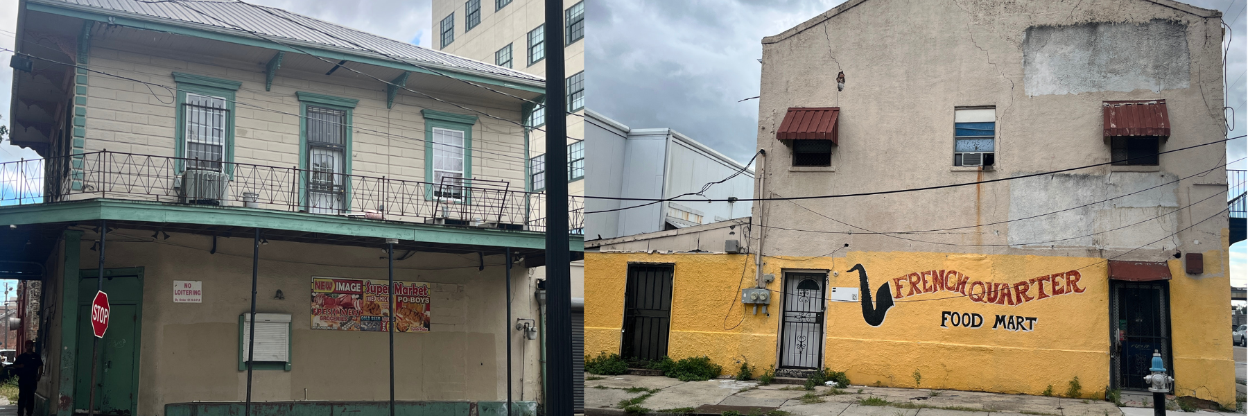
New Orleans Code Enforcement employs overly aggressive demolition practices by rebranding "Imminent Danger of Collapse" as the vague "Imminent Dangerous Conditions," This circumvents Historic District Landmarks Commission and City Council review. Since early 2024, 203 of 216 IDC demolition permits have been granted, with the others under review. Structurally sound buildings now become "emergency" demolitions without transparent criteria, rationale, or process. Minor violations escalate to demolition before exploring alternatives, leaving vacant lots where historic architecture—key to the city's appeal—once stood. Code Enforcement prioritizes  speed and numbers over preservation, destroying irreplaceable heritage while undermining community input and setting dangerous precedents.


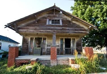
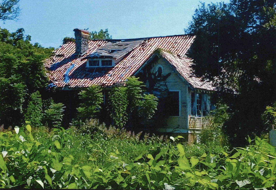
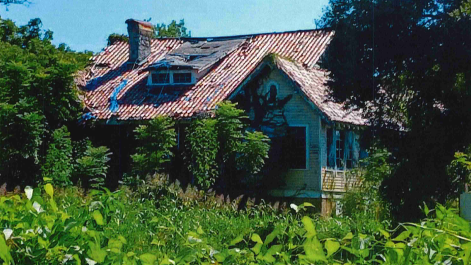
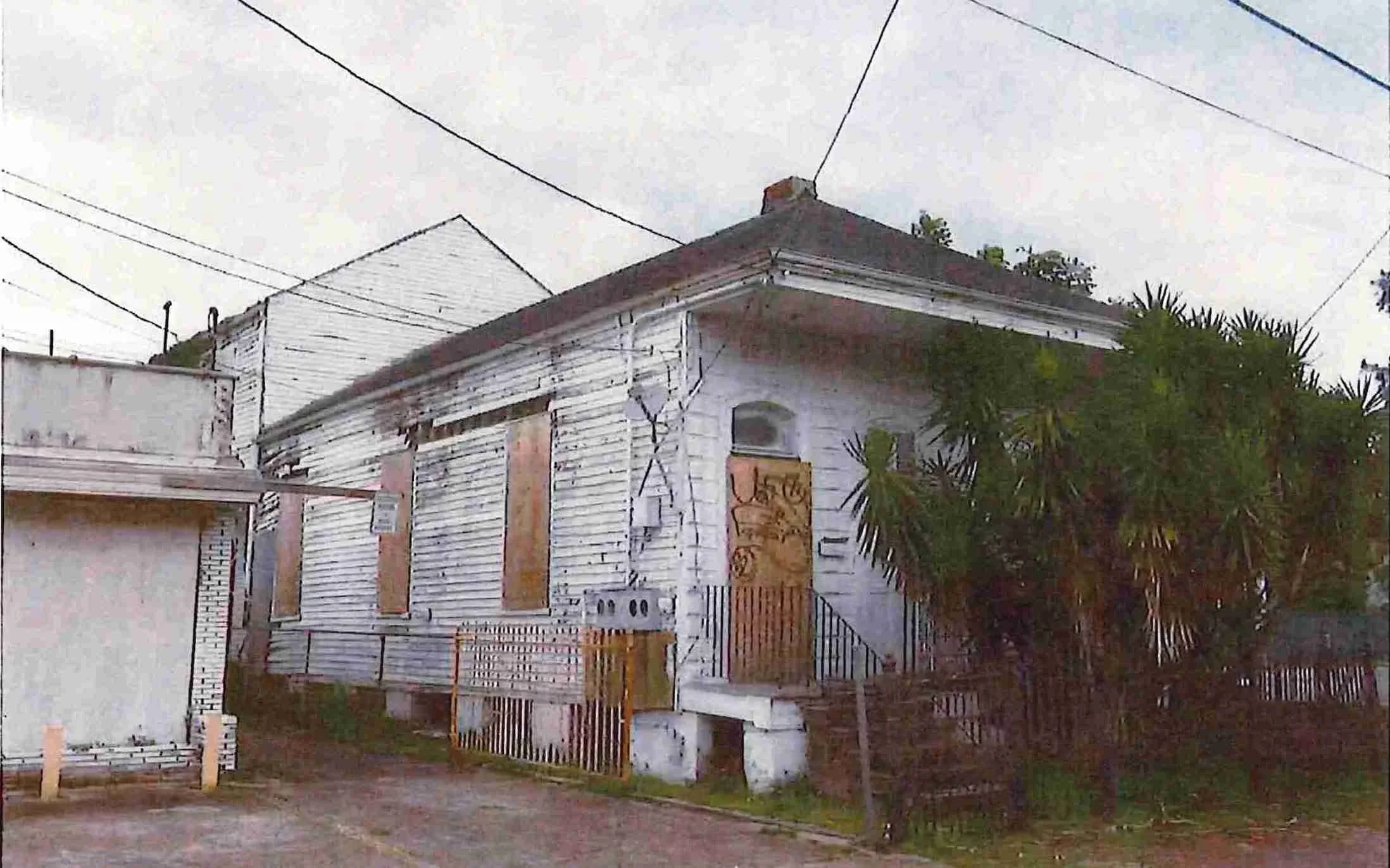
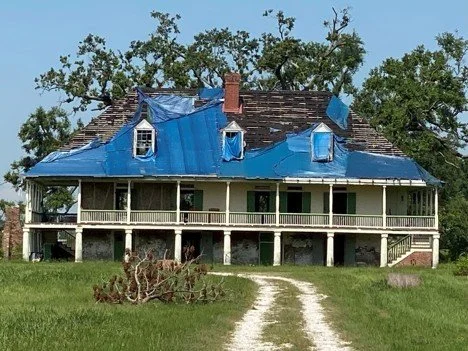
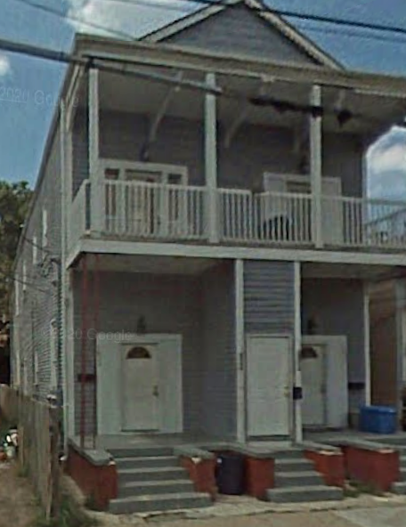
Dr. Alfred and Minnie King House

LOCATION: 2020 Farragut Street  

THREAT: Demolition by Neglect

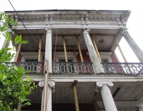
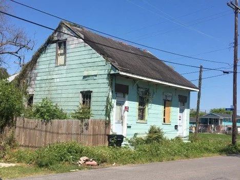
In 1932, Dr. Alfred King acquired an expansive parcel near Algiers Naval Station, where he and his wife built an idiosyncratic interpretation of a Colonial Revival-style raised cottage. After Dr. King died in 1933, his widow remained there until 1951, cultivating celebrated gardens. From 1952 until 1970, Dr. King’s nephew Vernon Lee Davis and his wife, both horticulturists, maintained this country home in the city. Today, the abandoned cottage is perilously dilapidated, obscured by vegetation. Although a developer acquired 2020 Farragut and the grounds of the demolished 2030 Farragut in 2017, neglect continues.


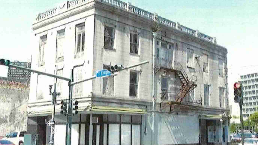
The Eagle Saloon

LOCATION: 401 South Rampart Street

THREAT: Demolition by Neglect

Built in 1850, the Eagle Saloon stands as a nationally significant early jazz landmark—one of the last survivors of "Black Storyville" along South Rampart Street. This sacred ground witnessed the musical genesis of legends like Buddy Bolden and Joe "King" Oliver, while serving the diverse "Back of Town" neighborhood that shaped Louis Armstrong's youth. Despite its 2002 National Register designation, the Eagle Saloon remains shamefully neglected: vacant, deteriorating, and forgotten. Redevelopment of other buildings in this jazz corridor are complete or underway. The Eagle Saloon must be prioritized for renovation.


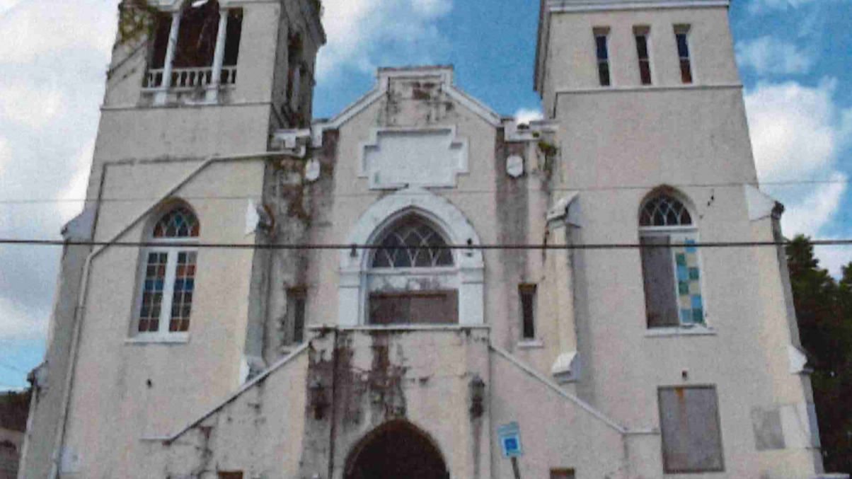
First African Baptist Church

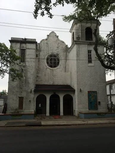
LOCATION: 2216 Third Street

THREAT: Damage and Lack of Funding

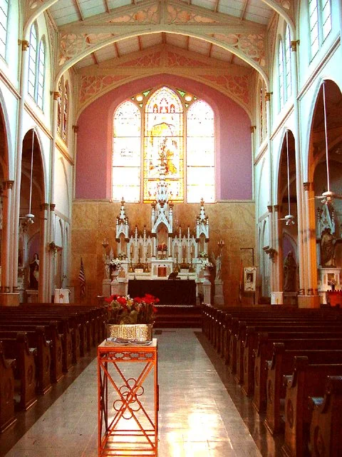
With roots dating to 1817, the First African Baptist Church is the oldest Black Baptist congregation in New Orleans and by some accounts the oldest continuous African American church in Louisiana. Construction began in 1904 on this Spanish Revival-style church in Central City that served as a space for religious and community gatherings, educational and cultural events, and political activism. The local landmark remained home to a thriving congregation until it became unusable after sustaining significant damage during Hurricane Ida in 2021. The congregation urgently needs funding to restore this significant site before the building becomes unsalvageable.


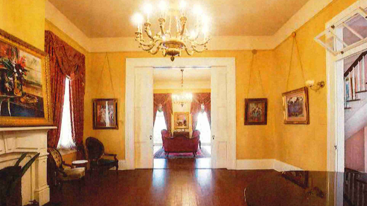
Historic Interiors

LOCATION: Citywide 

THREAT: Removal of Historic Heritage 

Contemporary taste for open floor plans and stark minimalism permanently removes much of our architectural heritage. Historic homes with lovingly restored exteriors are being brutally gutted and transformed into sterile white boxes that obliterate authentic character. Fireplaces, molding, trim, pocket doors, flooring, and sometimes entire walls are all sacrificed to appeal to the most generic market possible. While buildings may need updates for modern use, stripping away historic character doesn't necessarily improve functionality—it creates bland spaces devoid of the warmth, history, and authentic New Orleans charm that once defined them.


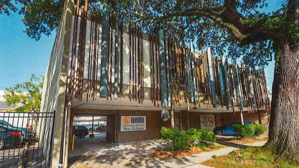
Midcentury Modern Buildings

LOCATION: Citywide

THREAT: Lack of Appreciation and Protection

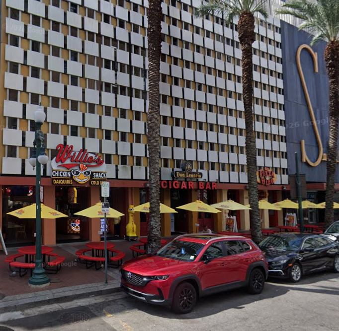
From the 1930s to the 1970s, New Orleans witnessed a robust and lauded modernist movement that transformed the city's skyline. However, midcentury modern buildings are often dismissed as untraditional in New Orleans. The Historic District Landmark Commission cannot protect most of these buildings because they were constructed after the National Register-defined periods of significance for historic districts, which

determines if a building contributes and must be regulated. Since the wave of midcentury modern demolitions following Hurricane Katrina, a troubling pattern has emerged where buildings from this era are labeled non-historic and unworthy of preservation.


St. Claude Corridor

LOCATION: 7th and 9th Wards

THREAT: Lack of Planning and Investment  

St. Claude Avenue, once a thriving business corridor, has experienced disinvestment and blight since the 2005 flood. Empty storefronts, blighted buildings, graffiti, trash, 
and dangerous traffic conditions reinforce the downward spiral. The lack of planning and public investment in the corridor to restore city services, beautify the neutral ground, 
and calm traffic discourages new investments while driving businesses like bars and restaurants into adjacent residential neighborhoods, where they come into conflict with residents. As a state highway, the city does not have full jurisdiction and will need cooperation from the state legislature to enact improvements.


The Rule of Law

LOCATION: Citywide 

THREAT: Open, Transparent, Accountable City Government

The rule of law is under attack by the city administration through systematic violations of public record laws, open meetings laws, zoning regulations, public notice and altering public documents. This administration has undermined transparent governance and is now threatening the authority of the Master Plan. Public confidence in city institutions and the consistent application of the law has eroded in the face of cronyism, where laws, regulations, and permits are applied based on the applicant's connections rather than legal merit and fair process. The result is ever more contentious public hearings, divisive politics, resentment and circumvention of regulations.


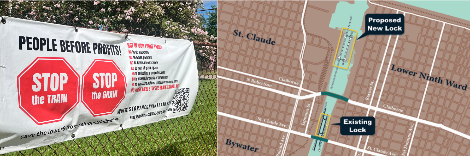
Excessive Industrialization

LOCATION: Ninth Ward

THREAT: Uncoordinated Over-Industrialization 

Excessive industrial intensification in the Ninth Ward threatens the area's hard-won post-Katrina recovery. The proposed grain train routing through residential streets, demolition of the historic St. Claude Bridge, creation of a Florida Avenue truck route, and replacement/relocation of the Industrial Canal lock prioritize industrial uses over neighborhood safety and sustainability. These projects sacrifice residential quality of life and local economies for expansion by non-local industries. They will devastate property values and drive out residents through increased noise, decade-plus construction, traffic, pollution, and flood risks. This uncoordinated hodgepodge approach lacks comprehensive planning and risks undoing decades of rebuilding efforts.

2024 New Orleans 9

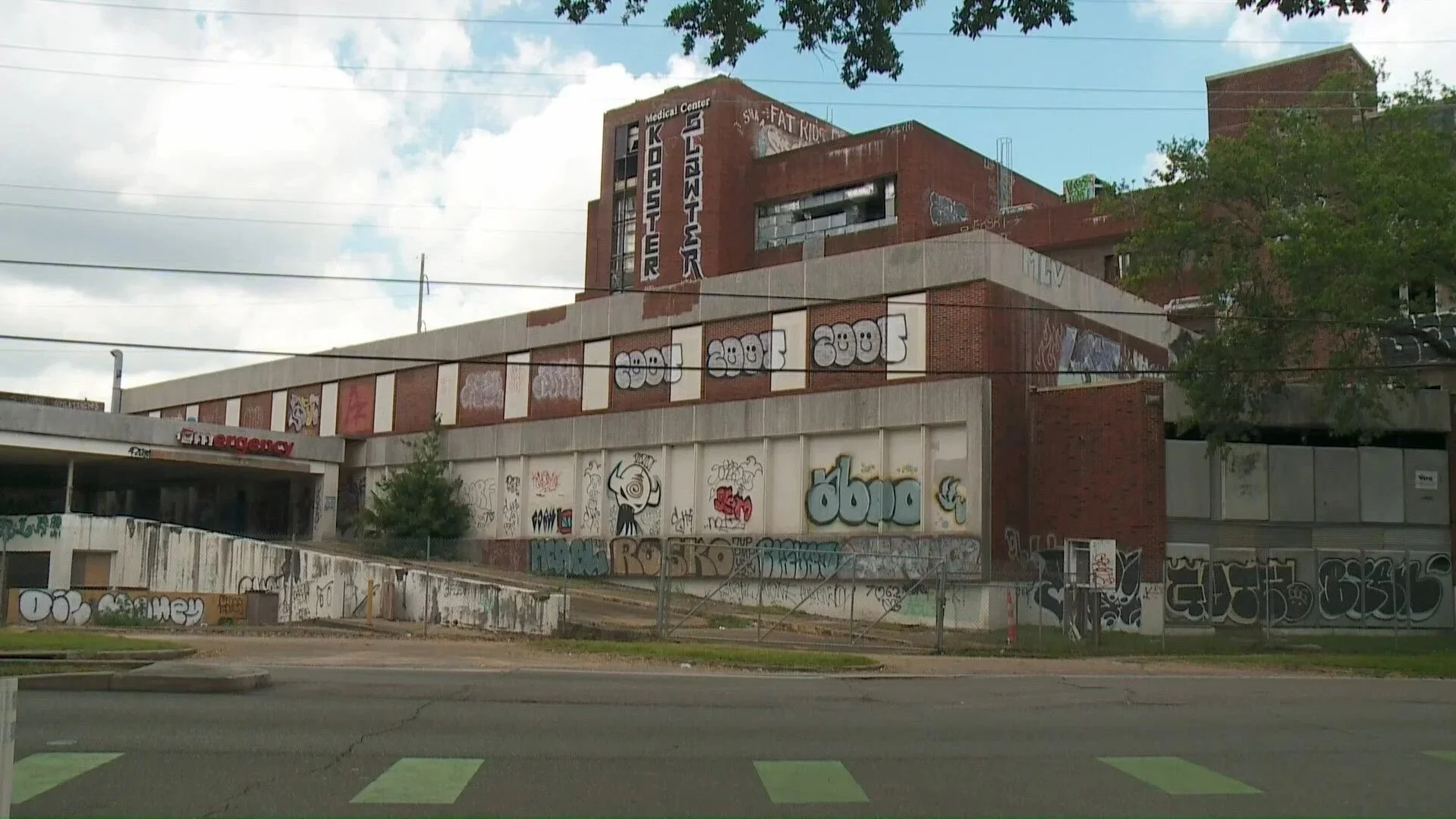
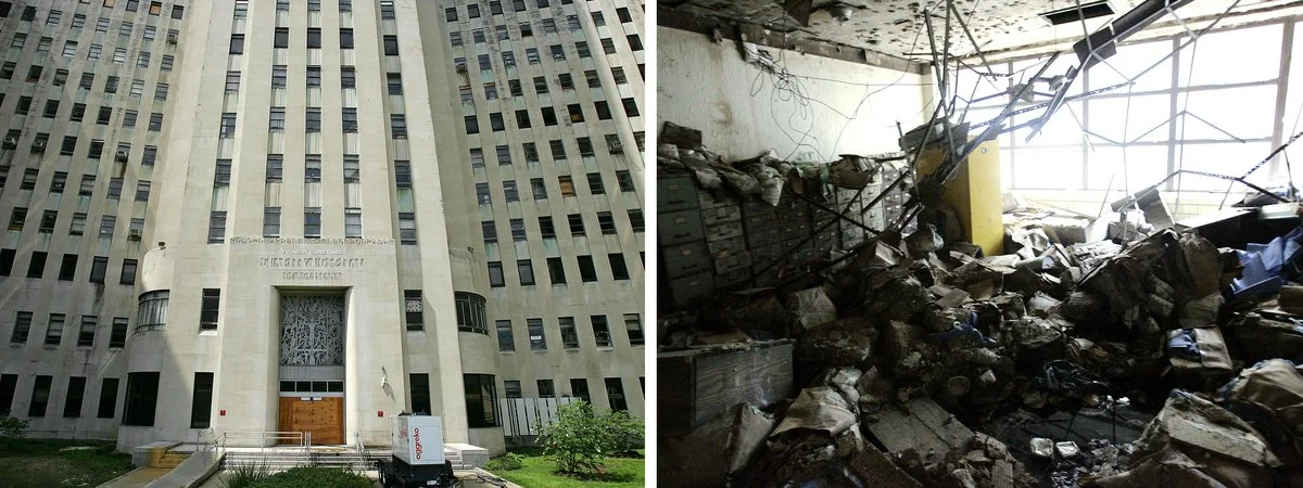
Lindy C. Boggs Medical Center (formally known as MERCY HOSPITAL)

Detriment to its Neighborhood

Severely damaged during Hurricane Katrina and subsequently vacated, this multi-building former healthcare institution, originally known as Mercy Hospital, occupies a prominent corner of the Midcity Historic District. Its campus includes mid-twenbeth century and later structures, which qualify for Federal Historic Tax credits. Plans to rehabilitate the property into a senior living facility have faltered due to financial and regulatory issues. The complex—deteriorating rapidly and marred with graffiti—continues as an eyesore. The current owners should rehabilitate the site or sell it.


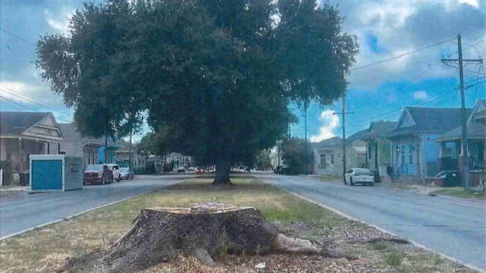
New Orleans Tree Canopy

Location: Trees Citywide

Threat: Loss of Tree Canopy

Our city’s tree canopy has dwindled to 18.5%, with recent damage due to negligent public works and utility projects affecting iconic oak trees and more. This loss intensifies flooding and heat island effects while diminishing the city’s unique visual character. Because the City lacks effective statutory procedures for tree preservation, the City Council must implement the Reforestation Plan and update City Code Ordinances to prevent further damage. Mandating compliance from municipal agencies and utility providers will safeguard this vital environmental, visual, and cultural asset, reduce flooding, and make the city more environmentally resilient.

Oretha Haley Castle Corridor

Location: Oretha Castle Haley Blvd.

Threat: Demolition by Neglect

For more than fifty years, Dryades Street (now O.C. Haley Blvd.) from downtown to Jackson Avenue remained an active commercial corridor serving the immigrant community and later the growing African American population. The end of racial segregation, suburban growth, and changes in shopping habits eventually stripped the corridor of its customers and commerce. O.C. Haley Blvd. was rediscovered and underwent a remarkable revitalization with a diverse mix of businesses. Nevertheless, several blighted and vacant commercial and residential properties remain within the corridor, blunting the economic revival and its sustainability.

Inner Harbor Navigational Canal (IHNC) Lock Replacement

Location: 9th Ward

Threat: Demolition and Future Flood Threat to Orleans & St. Bernard Parishes

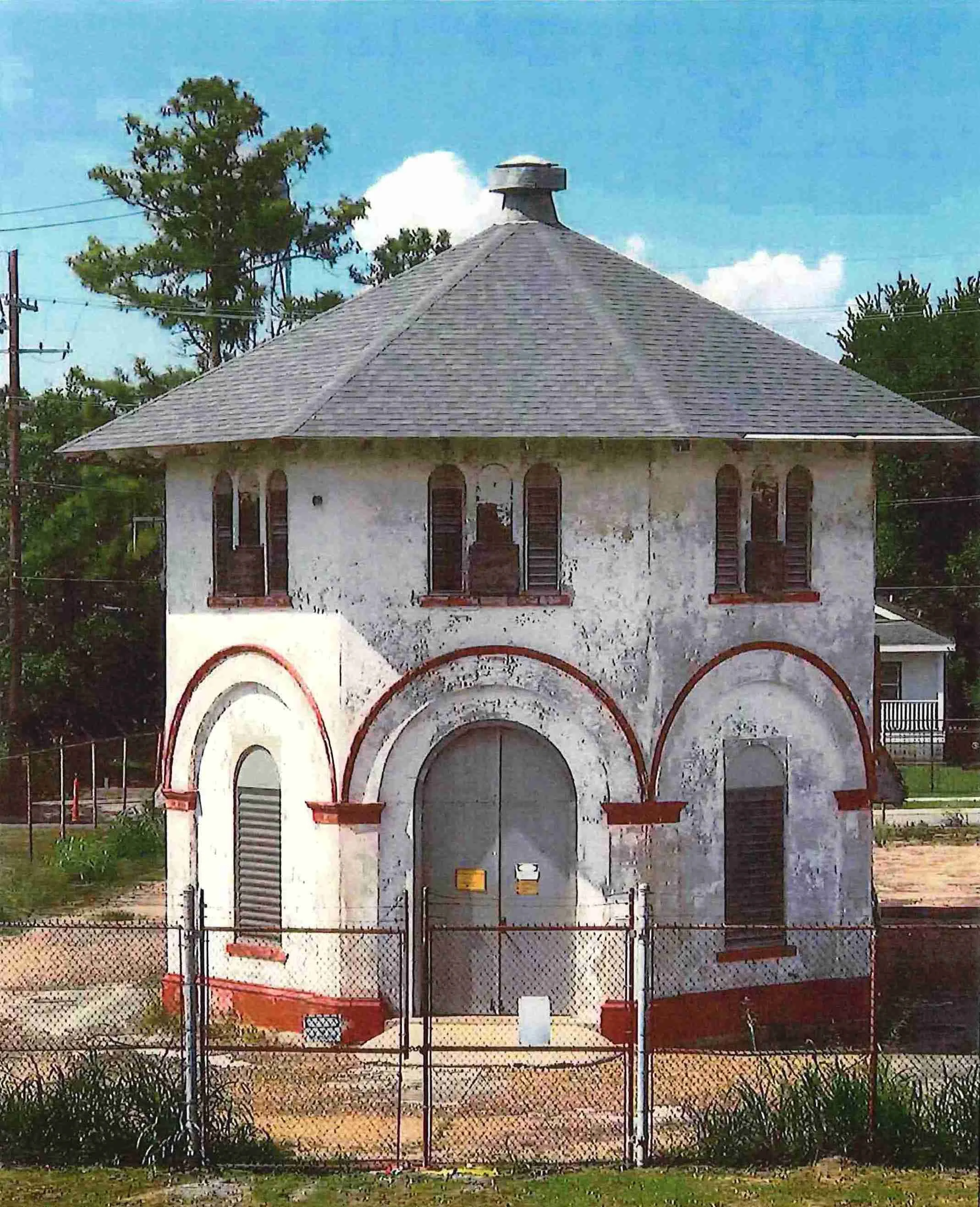
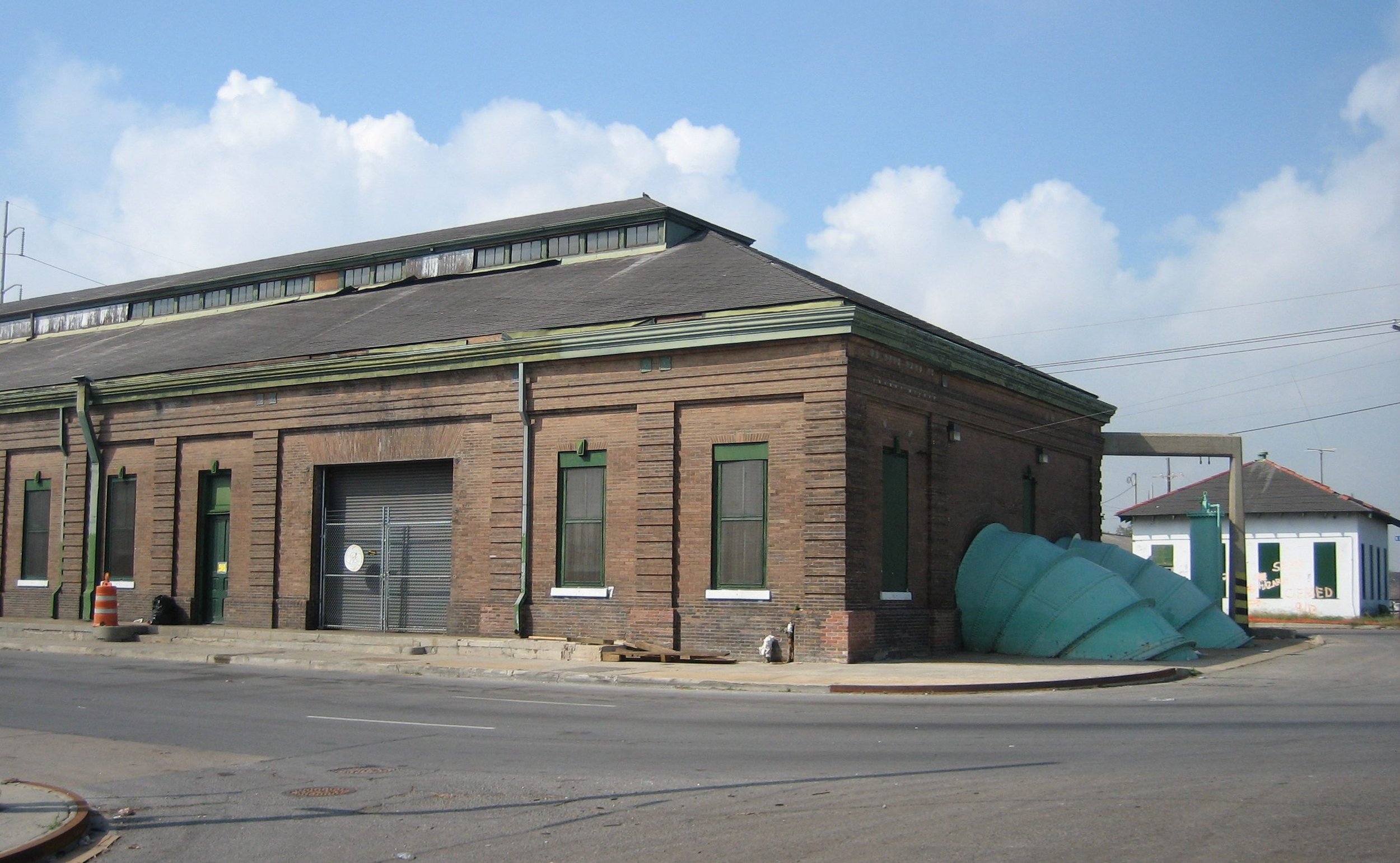
In 1903, architect James Armstrong designed nine Mediterranean-style S&WB pumping stations. Station B faces demolition to make way for a new St. Claude Ave. bridge as part of the Inner Harbor Navigational Canal (IHNC) Lock Replacement, along with the 4500 block of St. Claude Ave. and the historic Bascule drawbridge. The lock replacement will extend the Mississippi River almost a mile into New Orleans, with the same type of levee infrastructure that failed catastrophically during the 2005 Federal Flood. This proposed project is based on outdated economic and transportation data and threatens the safety of the entire East Bank.

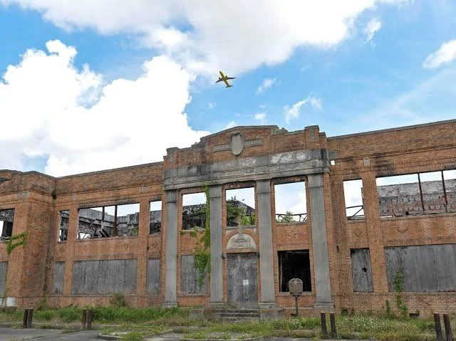
The Slaughterhouse

LOCATION: 301 Alabo Street

THREAT: Demolition by Neglect

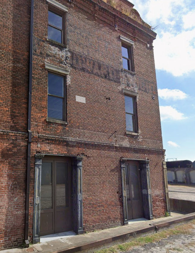
In post-Civil War New Orleans, manure, blood, and offal from numerous slaughterhouses contaminated water drawn from the Mississippi River, creating a public health hazard. Louisiana responded by mandating a single slaughterhouse downriver of the city. Butchers sued, claiming the 14th Amendment protected their livelihoods. The Supreme Court ruled against them, deciding that the 14th Amendment did not apply to state laws, thus setting the stage for Jim Crow laws. Owned by the Port of New Orleans, the slaughterhouse buildings, exemplars of 19th-century brickwork and threatened by neglect.

Closure of Catholic Churches

Location: Citywide

Threat: Closure of Catholic Churches

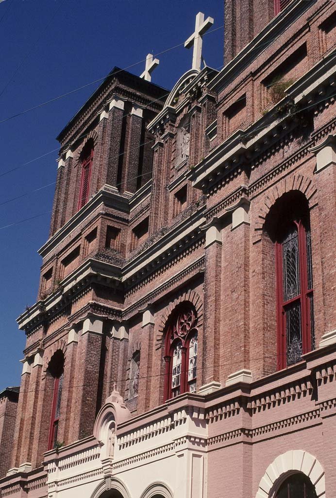
As of June 2024, the Archdiocese of New Orleans has closed 10% of its parishes, adding to the previous merger of 40 parishes and closure of 27 churches since Hurricane Katrina. This shift profoundly impacts the city’s historical and architectural landscape. In Orleans Parish, four notable churches face sale: St. Theresa of Avila (Gothic Revival, 1848), Our Lady Star of the Sea (Byzantine Revival, 1930), St. James the 4 Major and St. Gabriel the Archangel (Midcentury Modern, 1953 and 1955). There is concern, as churches’ intended use is becoming largely obsolete, and they are notoriously difficult to adapt.

Big Green Easy Plan: Parks and Green Spaces

Location: Recreational and Green Spaces

Threat: Non-Action -- Big Green Easy Plan

New Orleans' smaller green spaces and recreational facilities have long been neglected. The recently completed comprehensive "Big Green Easy" Master Plan addresses this, proposing to consolidate management, improve existing parks, and create new ones. It aims to foster community, health, and sustainability while adapting to water-related challenges. If the Plan becomes law, it could increase the quality and accessibility of parks and green space. Public support is crucial to move it through the Planning Commission, Council, and Mayor’s offices. It is not law.

Lower Garden District

Location: Basin Street Neutral Ground

Threat: Loss of Green Space

The Neighborhood Participation Program (NPP) is not meeting its mandate to effectively involve residents in land use decisions. Meetings lack substance, with consultants gaming the system to meet minimal requirements rather than engaging in meaningful dialogue. Issues include unrealistic meeting times, inaccurate or absent information, questionable reporting practices, and “bait and switch” tactics where final projects differ significantly from the NPP presentations without any further public notice. Advocates are pushing for improvements, including requiring accurate, informative presentations, convenient meetings, official notetaking, video recordings, stricter follow-up mechanisms for changes, and penalties for non-compliance to enhance transparency.

Proposed River District Development- Topgolf

Location: Lower Garden District

Threat: Inappropriate, Out-of-Scale Development

The lauded 19th-century Lower Garden District faces a looming threat from the proposed Topgolf facility within the River District development. Initially, developers promoted plans for affordable housing and a grocery store at the site. Residents were blindsided when the City Council passed a text amendment allowing 175-foot poles, revealing Topgolf's involvement. The lack of transparency and meaningful public input exemplifies systemic issues in the city's development process. The behemoth structure, visible citywide, starkly contrasts with the neighboring National Register Historic District's low-scale residential character. Current zoning processes endanger all of New Orleans' cherished historic neighborhoods.

 2023 New Orleans 9

Madame John’s Legacy

Location: 632 Dumaine Street

Threat: Insensitive Alterations 

Madame John’s is one of the Vieux Carré's oldest structures, dating to 1788 or earlier. It is a prime example of 18th-century Louisiana Creole architecture, and one of Louisiana’s most significant National Historic Landmarks. Having survived the Fire of 1794, this treasure faces a new threat: controversial plans for significant, inappropriate design changes. Until the 1990s, the VCC had input over state-owned buildings—but no more. Although the Louisiana Division of Administration Facility Planning has oversight, and despite guidance from the State Historic Preservation Office and the Louisiana State Museum’s independent consultant, the contractor is moving forward.

Residential Housing

Location: Citywide

Threat: Availability of Residential Housing 

Designated as a local landmark, this former branch bank is a Mid-Century Modern commercial building designed in 1966 by architects Parham and Labouisse in the New Formalism style, a rare building type in traditional New Orleans. The exterior has missing or incongruous marble elements and is covered with graffiti on the building façade and perimeter wall. Once an important contributor to the Mid-City neighborhood, the landmarked building now presents a neglected and forlorn appearance that blights the prominent corner of Canal and North Broad Streets.

Adolph Mazureau House

Location: 1016 St. Louis Street

Threat: Demolition by Neglect 

In 1831, prominent notary Adolph Mazureau commissioned Daniel Twogood, builder of Julia  Row, to construct this complex on the edge of today’s French Quarter. This finely-designed Federal-style townhouse with its pilastered carriageway entrance, service wing, and stable, has both charmed and dismayed admirers for decades. Owned since 1909 by Mercier Realty, this landmark and other Mercier holdings have been allowed to deteriorate, soliciting frequent citations by the Vieux Carré Commission.

City Hall

Location: 1300 Perdido

Threat: Prime Location   

City Hall was erected in 1957 in the administration of Mayor DeLesseps “Chep” Morrison, whose master plan for a new civic complex included a modern City Hall with a public plaza, a library, state courthouse, and a state office building located on the newly widened Loyola Avenue. The Mid-Century Modern-style façade of green-tinted windows set in a modular grid with aluminum louvres reflected the city’s post-WWII optimism. Despite the building’s architectural and cultural significance, recent administrations have shown little interest in preserving the building, while exploring relocation options—leaving the potential for demolition very real.

Mid Century Modern

Location: 1016 St. Louis Street

Threat: Demolition by Neglect 

Designated as a local landmark, this former branch bank is a Mid-Century Modern commercial building designed in 1966 by architects Parham and Labouisse in the New Formalism style, a rare building type in traditional New Orleans. The exterior has missing or incongruous marble elements and is covered with graffiti on the building façade and perimeter wall. Once an important contributor to the Mid-City neighborhood, the landmarked building now presents a neglected and forlorn appearance that blights the prominent corner of Canal and North Broad Streets.

HDLC/VCC Commissions 

Location: Citywide

Threat: Overturning Commission Decisions  

The Historic District Landmarks Commission (HDLC) and the Vieux Carré Commission (VCC) are responsible for the preservation, protection, and regulation of the distinct architectural and historic character of the city's designated historic districts. Staff recommendations are based on professional expertise. The City Council’s frequent overturning of decisions made by the HDLC and VCC undermines the professionalism, authority, and ultimate goals of the commissions.  Supporting the expert analyses and rulings of the commissions is paramount to retaining the historic integrity of our city.

Louis Armstrong Park

Location: 701 N. Rampart

Threat: Insensitive Redevelopment 

Louis Armstrong Park, named for New Orleans’ world-revered native son, is home to several historically and culturally significant buildings and sites, including Congo Square—crucial in  African American history and essential to the creation of jazz and popular music. As plans advance to develop a world-class cultural center within the 32-acre park, the City and the community must stay vigilant to ensure that the entirety of the site remains in public domain while reflecting the community’s vision, and is redeveloped with sensitivity and respect for the past.

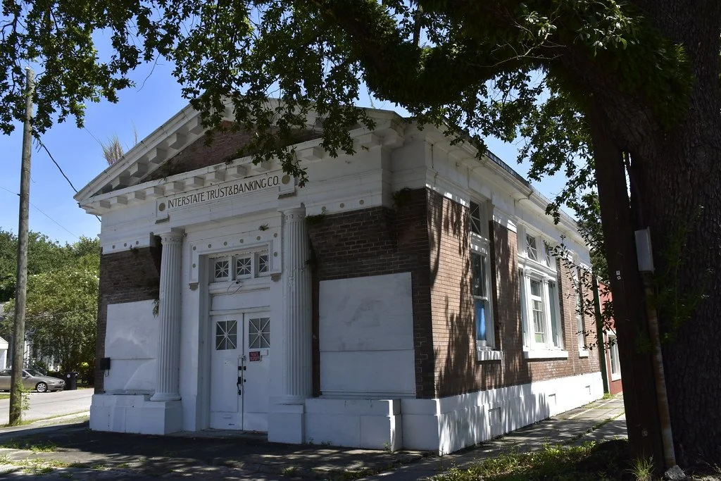
Interstate Trust & Banking Co. Building

Location: 644 Bouny Street

Threat: Demolition by Neglect 

This long-vacant, architecturally significant bank building is sited on a viable commercial corridor in Algiers Point. The solid brick structure, however, suffers from the effects of water intrusion through the damaged slate roof; from wood rot; and from damage caused by rodents,  termites, and the overgrowth of vines along the entablature. In addition, the original bay windows have been removed from the entrance façade. The restoration and rehabilitation of the building would enhance the historic neighborhood of Algiers Point.

Garden of the Americas

Location: Basin Street Neutral Ground

Threat: Loss of Green Space 

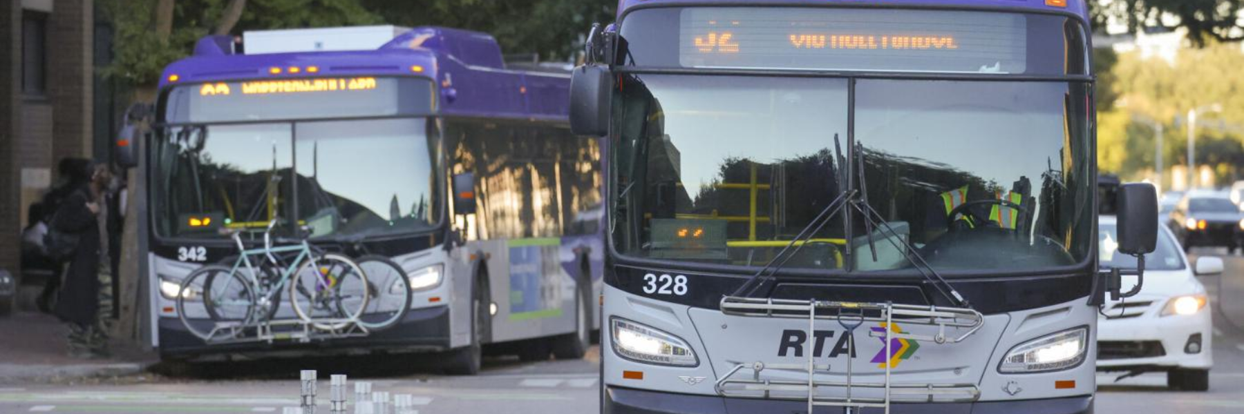
The “Garden of the Americas” was developed in 1957 on the Basin Street neutral ground to honor New Orleans’ economic and cultural ties to South America. From Canal to St. Louis  Street, the Garden features several monuments. While the failure to maintain the Garden and  Simon Bolivar Plaza has long been a civic embarrassment, the site is now endangered by  New Orleans Regional Transit Authority’s selection of the neutral ground for a new transit corridor bus terminal – instead of choosing less impactful alternatives such as the Union  Passenger Terminal.

 2022 New Orleans 9

Lack on Enforcement

Location: Citywide

Threat: Diminished Predictability & Quality of Life

Blighted buildings. Overgrown vacant lots. Noise. Short-term-rentals. Restaurants that are actually bars. And more! Nothing frustrates New Orleanians more than lack of enforcement of our laws, rules and the Comprehensive Zoning Ordinance. The city’s Safety and Permits office often issues approvals for permits based on nothing more than the assurances of applicants. The Department of Code Enforcement has been inconsistent in verifying the applicant’s actual use. The Administration fails to hold departments accountable. Inadequate city agency budgets lead to a shortage of inspectors. Citizens suffer when regulations, quality-of-life laws, city code and land-use zoning fail to create predictability. Without enforcement, none of the rules and laws can make any difference.

Shotgun Vernacular

Location: Citywide

Threat: Loss of an Iconic Design

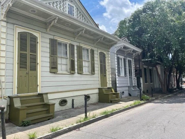
The renowned New Orleans single-story, single and double shotgun home may seem ubiquitous as an architectural style. However, true “shotguns” are becoming increasingly rare as they are purchased, gutted of their iconic plan, camel-backed, and flipped. Besides drastically modifying the quintessential shotgun plan, McMansion-style additions alter the scale of our historic neighborhoods, while the conversion of double shotguns to single homes contributes to the depletion of much-needed affordable housing stock. Similar to the disappearing dogtrot style, the shotgun plan is becoming lost as both interiors and exteriors are modified – no longer qualifying the home to be considered a true “shotgun”. 

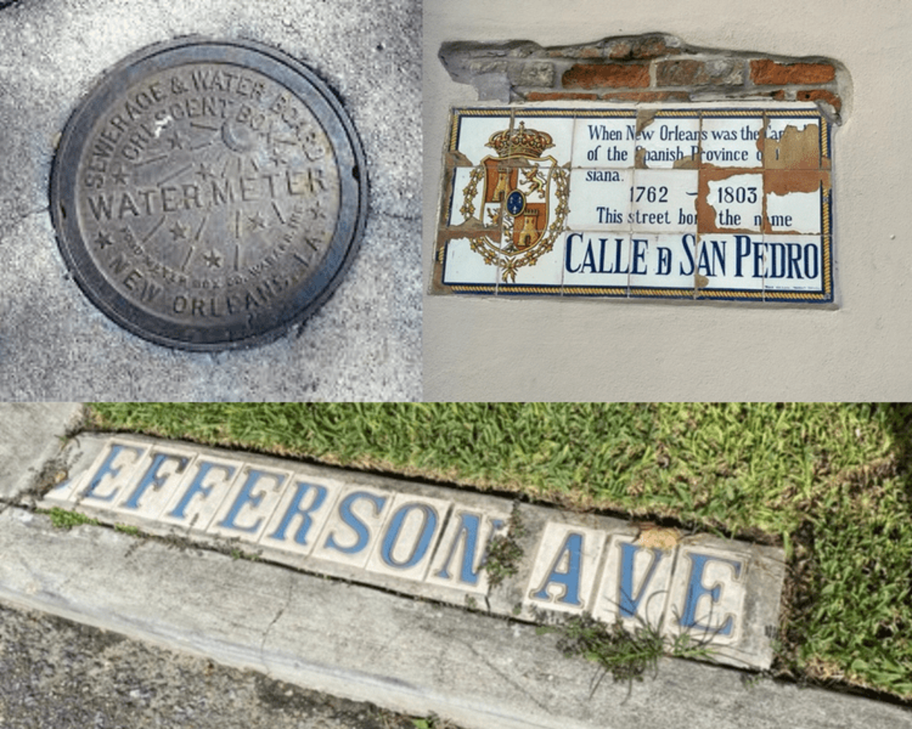
Iconic New Orleans Detailing

Location:  Citywide

Threat: Theft, Vandalism, Non-Replacement

It is said that “God is in the details” – and in New Orleans we are losing those details at a rapid pace. Whether it is the iconic New Orleans’ ceramic tile street markers, the Sewerage and Water Board’s much-loved and replicated water meter covers, the Spanish street wall plaques in the Vieux Carré, or the granite curbs that used to line our streets – these historic details are quickly vanishing. Through breakage, theft, vandalism, and/or the city’s desire to save money, these seemingly inconsequential, individual losses actually erode the historic character of the city piece by piece.

Keller Home

Location: River Road  

Threat: Disagreement of Heirs & Developmental Pressures  

One of the last remaining large French Colonial raised cottages now sits in desolation only 30 minutes outside of New Orleans. Built in the 1790’s, this home reveals exposed West Indian style bousillage construction, with original features such as cypress floors, mantles, marble tile on the first floor, and more. Declared a National Historic Landmark and listed on the National Register of Historic Places in 1970, the home is threatened by encroaching industrial companies continually appropriating prime river-fronting land, housing developments capitalizing on acreage, complications and differing objectives of the heirs, and recent damage from Hurricane Ida. This once lively family home is in desperate need of stabilization and repair.

Moss Street Corridor

Location: Bayou St. John Neighborhood

Threat: Inappropriate Development

The quaint, historic Moss Street corridor and Bayou St. John neighborhood are being rapidly transformed. Inappropriate construction has led to historic homes being demolished; cottages being hoisted into the air and modified beyond recognition; inappropriate, bayou-fronting double garages; and massive alterations and construction that are out of scale and character for the neighborhood and scenic bayou waterfront. Elements that made the area so attractive are being lost. Creating a full-control historic district would help allay these inappropriate, intensive developments and aid in retaining the desirous Moss Street corridor and Bayou St. John neighborhood.

Plaza Tower

Location: 1001 Howard Avenue

Threat: Abandonment and Neglect

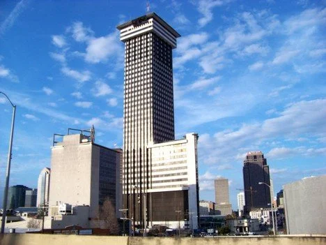
Described at its completion in 1969 as a “brilliant and magnificent edifice”, the Plaza Tower at the prime location of Loyola and Howard Avenues in downtown New Orleans has long suffered from a fall from economic importance and architectural grace. The Leonard Spangenberg, Jr. designed tower, once the tallest in Louisiana, is now empty and deteriorating, with building elements occasionally falling dangerously to the street. The “alphabet soup” of ownership, “revolving door” of management, and the loss in 1996 of a state lease due to building problems have left the tower without tenants for more than twenty years, standing as a blight on downtown and as an embarrassing eyesore for the city. Update: the landmarks nomination of the Plaza Tower will be considered by the CBD HDLC on March 1, 2023.

Perseverance Hall

Location: 1644 N. Villere Street

Threat: Hurricane Damage and Neglect

This important jazz landmark in the Seventh Ward neighborhood suffered near-catastrophic damage from the winds of Hurricane Ida. Structural failure included the complete collapse of the rear wall and near collapse of the two side walls and roof, with only the front façade remaining intact and upright.

Long before becoming a church, the hall was home to the Perseverance Benevolent Mutual Aid Association and hosted performances by many early jazz musicians whose music had a profound impact on American society and culture. With the loss locally of so many early jazz venues, it is critically important that all remaining sites be protected and preserved out of respect for that history and in honor thereof.    

Valence Street Baptist Church

Location: 4636 Magazine Street

Threat: Demolition by Neglect

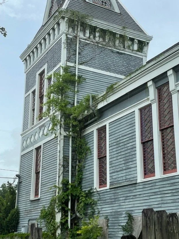
Designed by prominent architect Thomas Sully in 1885, this Landmark church building is believed to be the first and one of only two church commissions by Sully during his 22 years of work in New Orleans. Built in the “Stick Style”, a design that represented a stylistic antecedent to the Queen Anne style championed by Sully, the church building is dominated by a distinctive square tower and has been credited as the most architecturally significant frame church in the city. Long a fixture along Magazine Street and for years described as “the country church uptown”, the church building is now forlorn and neglected, a former neighborhood anchor now in decline on a busy, thriving commercial part of Magazine Street.

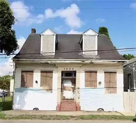
Creole Center Hall Cottage

Location: 1406 Elysian Fields Avenue

Demolition by Neglect

Decades of residents of this formerly distinguished home and dependency on Elysian Fields Avenue were witnesses to history. The Creole center hall cottage on Elysian Fields Avenue in Faubourg St. Roch had a front row seat on the route of Smoky Mary and its one hundred-year run carrying passengers and freight out to Milneburg on Lake Pontchartrain, as well as to the emergence of New Orleans Jazz as practiced and perfected by the neighborhood’s early musical legends including Jelly Roll Morton, Sidney Bechet and Paul Barbarin. Now the home sits vacant, threatened, deteriorating, and neglected. With care and attention, this home could once again reclaim its proper role as a witness to yet more history.  

 2020 New Orleans 9

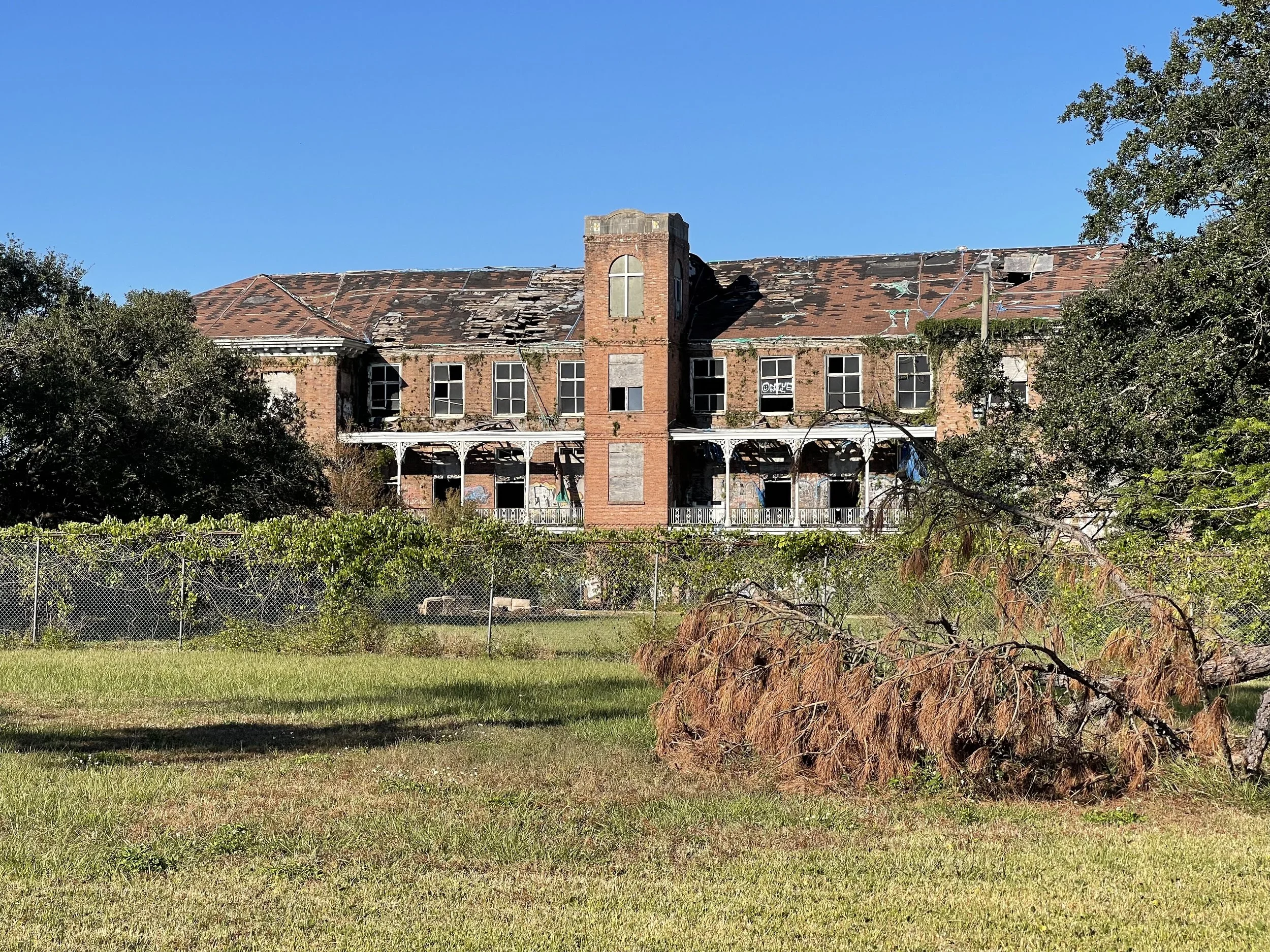
Holy Cross School

Location: Holy Cross Neighborhood

Threat: Demolition by neglect/ lack of code enforcement

Designed by famed architect James Freret, this 1895 building is the last surviving building of the Holy Cross institution for which the Holy Cross neighborhood is named. Since 2012, the developer has promoted the building would be rehabilitated as the centerpiece for a redeveloped site. Even then, the project was controversial as the community opposed re-zoning the property to accommodate plans for two massive towers. In 2014, the Louisiana Landmarks Society named the district to its NO9 Most Endangered Sites list when it was threatened by the out-of-scale plans. Eight years later, plans for the towers have been lowered- but the building continues to deteriorate. Teh owner now refers to the property as a “burden: as the roof and interior areas have been allowed to partially collapse. With no solid plans to begin the redevelopment, the Holy Cross building sits in real danger of collapse- a fate suffered last year by the historic Semmes School just blocks away.

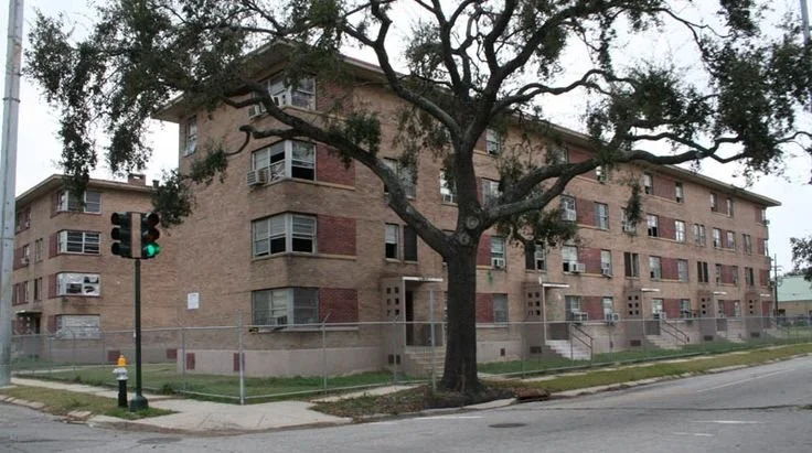
B. W. Cooper, Surviving Buildings

Location: 1117 South Galvez Street

Threat: Disuse; Waste of needed resources

Three vacant brick buildings are all that remain of the B.W.Cooper Housing Development. Built in 1939-1941 for the US Housing Authority and its local counterpart, the Housing Authority of New Orleans, it is perhaps better known as Calliope. B. W. Cooper was one of four New Deal era developments targeted for revitalization in the wake of Hurricane Katrina. A demolish-and-rebuild, mixed-income model similar to that used at the St. Thomas development before the storm carried the day, as agencies in 2007 agreed to demolition of all but these remaining structures. This March, six years after the demolitions, HANO issued an RFP for the final phase of redevelopment, which included these sturdy brick structures- but a developer has yet to be selected. Economic problems resulting from COVID-19 have worsened the already acute problems of housing insecurity in New Orleans. Fast-tracking the redevelopment can provide homes for many in need.

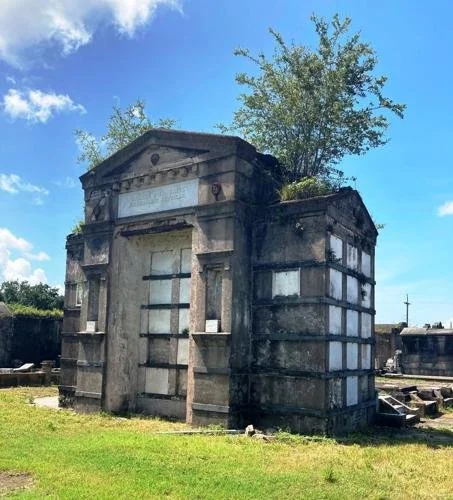
French Benevolent Society Tomb

Location: 2110 Washington Avenue

Threat: Deterioration from abandonment and neglect

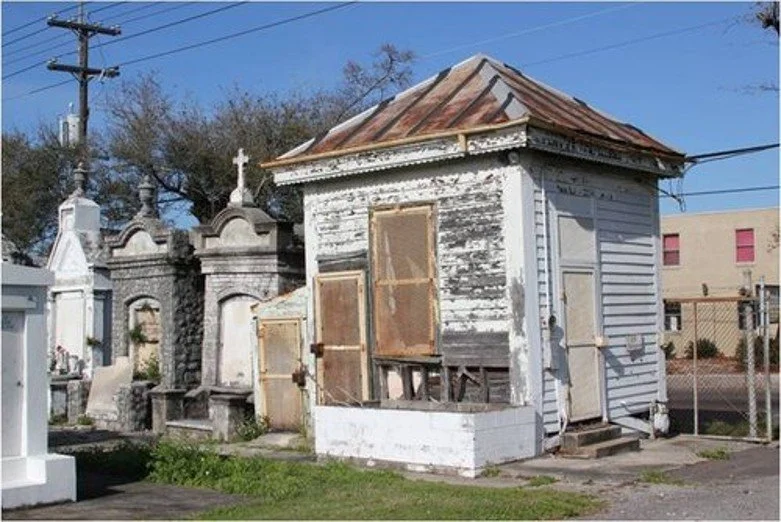
Prominent among the extraordinary assemblage of tradesmen’s society tombs in Lafayette Cemetery No. 2 is the imposing, 40-vault c. 1872 French Benevolent Society of Jefferson Tomb. It stands as an architectural and cultural remnant of the working-class benevolent society founded in 1868 in the former City of Jefferson. The tomb serves as the final resting place of 150 new Orleanians of French ancestry, including many children. With membership declining, the society merged with the French Benevolent Society of Orleans in 1901. After celebration of its centennial in 1943, the merged society began its own decline and dissolved in 1972. The end of the French society left the tomb orphaned and abandoned, resulting in long-term neglect and deterioration, with damaging tree growth from the roof. Reconstitution of the society may be possible, allowing for a return to active ownership and tomb restoration and maintenance.

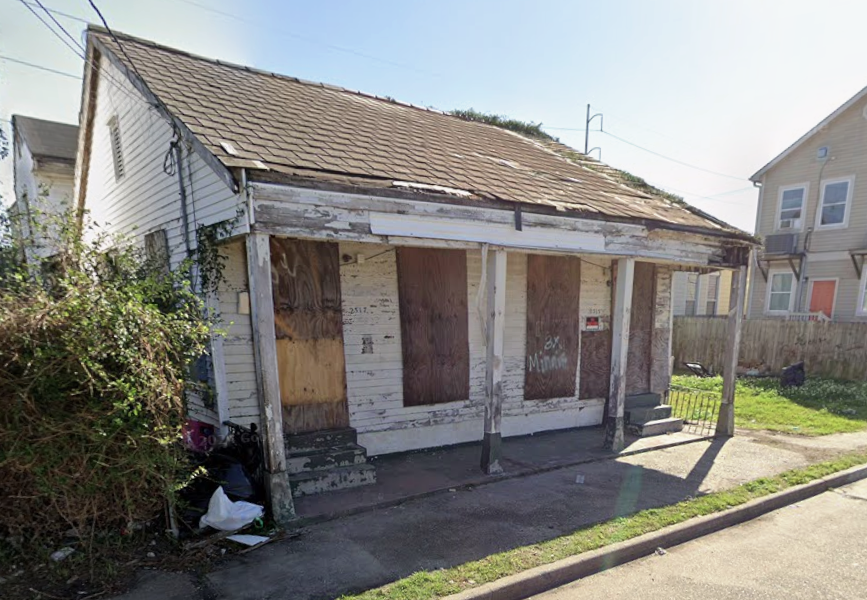
1860's Cottage St. Andrew Street

Location: 2315-17 St. Andrew Street

Threat: Demolition by neglect

With the J. H. Keller Soap factory nearby, this 1860’s cottage was likely constructed to help meet workers’ housing needs. This serviceable double received a two-story rear addition in the late 19th century. Advertisements confirm the building was primarily leased for rental income until the 1950s, when it was purchased by the first known owner-occupants. Post-Katrina photos taken as part of a FEMA survey of the Central City National Register District suggest the home was in better condition at that time than the situation today, with windows boarded and vines climbing the weatherboards. The out-of-state owner sought demolition in 2018 but later withdrew the application. Neighborhood advocates fear it will suffer demolition by neglect or be sold to an investor not interested in a historically sensitive rehabilitation. However, it could qualify for both state and federal tax credits.

French Quarter Residential Streets

Location: French Quarter

Threat: Limitation of street usage

New Orleans was a scattershot collection of cabins in 1721 when engineer Adrien De Pauger drafted a six-by-eleven block grid of streets centered around a church on an open square fronting the Mississippi River. Streets designed to accommodate horses, wagons, carriages, streetcars, and automobiles are now being converted into tourist-oriented “pedestrian malls.” Pedestrian malls already exist at Jackson Square and on Royal and Bourbon Streets, where the City has shown an inability to manage rampant problems of crowding, illegal vending, relentless noise, and accumulated waste. City Hall now proposes to close multiple streets for additional pedestrian malls. Further restricting personal vehicles, delivery trucks, and emergency vehicles would hinder the viability of the quarter as an authentic mixed-use neighborhood and contribute to additional residential population decline. The Vieux Carre should be protected as a genuine, functioning historic neighborhood.

University Area Housing

Location: University area neighborhood

Threat: Losing homes to high-end student housing

In an alarming disruption of the housing market similar to short-term rentals, developers are purchasing small, historic residential properties in the University Area, adding as many as ten bedrooms, and converting them into monstrous, high-end dormitory suites. The units are then rented to college students for about $1,500.00 a month per bedroom. Maximizing the number of bedrooms is the driving design principle, overwhelming the lots and the architectural style. Once converted, the former cottages become unusable for permanent residents, while high profit margins allow developers to outbid locals, aggravating the housing shortage and interfering with the long-term relationships essential to healthy neighborhoods. Because the developers are packing 10-12 bedrooms into 30-foot lots, the existing on-street parking shortage bedrooms into 30-foot lots, the existing on street parking shortage is exacerbated. In an attempt to slow the loss of housing stock, Councilmember Giarrusso fought for a temporary moratorium. Potential long-term solutions include tying intensifications to homestead exemptions, requiring more common living area, increasing assessments on intensive conversions, enhancing parking regulations, and changing zoning regulations and the level of HDLC oversight.

Buddy Bolden Home

Location: 2309 First St.

Threat: Demolition by neglect

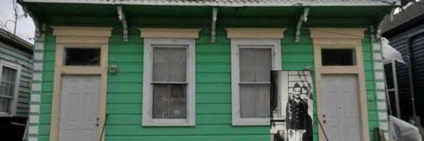
Other than the state asylum where he lived out his years, the only known home of pioneer jazz trumpeter Charles “Buddy” Bolden was 2309-11 First Street. The modest double shotgun was purchased by Greater St. Stephens Full Gospel Baptist Church in 2008. Understanding its provenance and city landmark designation, preservationists and music aficionados saved the building from the wrecking ball after the church filed for demolition, only to have it continue to be cited for various code violations. Subsequently, musician P. J. Morton, son of the church ministers, formed a non-profit with plans to preserve the building as a museum and convert an adjacent double into a recording studio and facility for aspiring musicians. Yet the building still remains vacant, and the adjacent building, also owned by the church, burned in April. Bolden’s former home continues to languish in an even more forlorn setting, with fears of further deterioration-or worse.

St. Alphonsus Church

Location: 2030 Constance Street

Threat: Severe deterioration

Designed by architect Louis L. Long and constructed by the Redemptorist Fathers and parishioners between 1855 and 1857, St. Alphonsus Church is listed on the National Register of Historic Places. The building has been home to an eclectic group, including Irish Catholics, the homeless, pigeons, and museum visitors. Now no longer a consecrated church, the Saint Alphonsus Art and Cultural Center hosts creche scenes, St. Joseph altars and other exhibits. Since the 1990s, the Friends of St. Alphonsus have worked to preserve the structure and repair the accumulated damage from years of deferred maintenance. But the needs are vast. The exterior envelope needs to be sealed, the roof needs replacement, the walls need repointing, and the stained-glass windows need restoration. Inside, the plaster walls and stunning fresco ceilings are crumbling and falling off the wooden lath skeleton. Eligible for historic tax credits, the building could be sold and redeveloped.

Safety and Permits/ Code Enforcement

Location: Citywide

Threat: Lack of inspections and enforcement

To ensure public health, safety, and welfare, municipal code enforcement is necessary. In recent years, New Orleans’ Safety and Permits Department enforcement has encountered obstacles such as underfunding, lack of capacity to carry out duties, the city’s 2019 cyberattack, and disturbing irregularities revealed by the collapse of the Hard Rock Hotel. Now, the consequences of the pandemic will force more budget cuts. Adding to the concern is the potential for the long-held mission of the department to be compromised by the recent administrative restrictions that may view residential communities as economic drivers. Some developers and property owners take advantage of the reduced services, threatening the safety of citizens and the workforce, the residents’ quality of life, and the structural integrity of our buildings. Improved inspections and enforcement safeguard much-needed predictability, safety, and values while providing the added bonus of an increased revenue stream for the city through the collection of fines.

2019 New Orleans 9

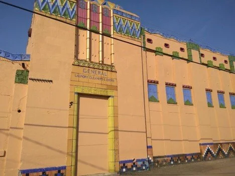
General Laundry Cleaners and Dyers

Location: 2532-26 St. Peter Street in Treme

Threat: Demolition by Neglect

Decades of negligence are willfully destroying “the most outstanding Art Deco building in New Orleans.” When the dazzling 1927 General Laundry was placed on the National Register of Historic Places in 1974, the report stated, “It epitomizes [Art Deco], as does no other... building in New Orleans....” In 2014, the current owner requested demolition but was denied by a deed restriction requiring State Historic Preservation Office approval. Today, damaged and partially roofless, this landmark is deteriorating; yet its brilliance shines to inspire anyone with eyes and heart. Note: In May of 2019, after being cited for code violations, the owners of the General Laundry building boarded the windows and doors, removed plant growth, and painted concrete portions of the exterior. However, a hole remains visible in the roof. This stop-gap measure to satisfy code enforcement falls well short of true restoration.

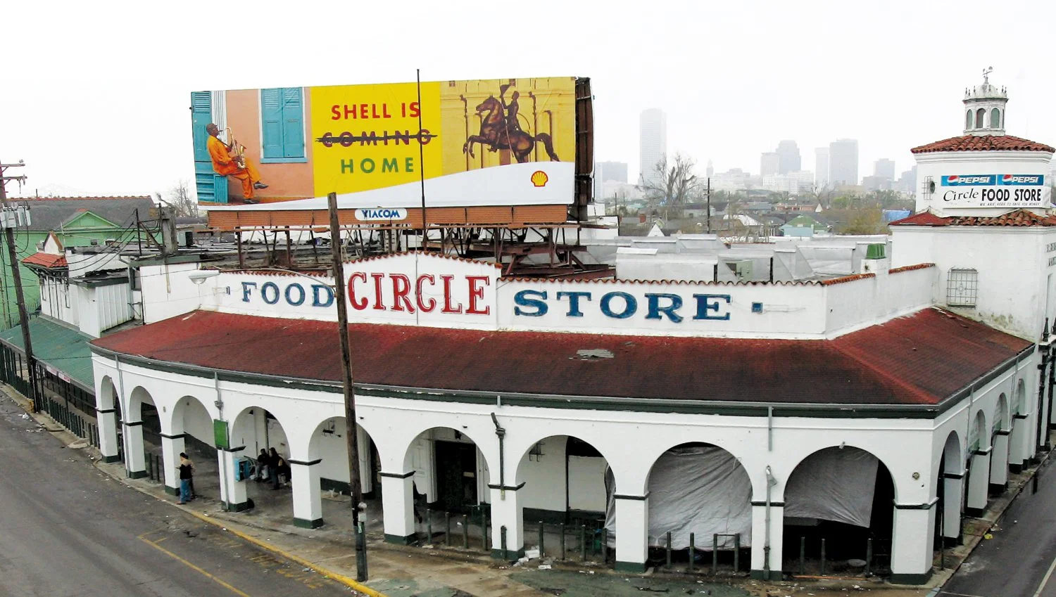
Circle Food Store

Location: 1532 St. Bernard Ave. in the 7th Ward

Threat: Repetitive Flooding

The iconic 1931 Circle Food Store, a beloved, black-owned community hub that offered fresh food, goods, and services to the Treme and 7th Ward neighborhoods, faces peril due to recurring flooding and development pressure. Designed by architect Sam Stone, Jr., the store was named for the St. Bernard Ave. traffic circle destroyed by the construction of Interstate 10. The grocery, acquired from the city in 1938 by an African-American vendor, replaced the St. Bernard Market, one of 36 markets. Following Hurricane Katrina, the building underwent an $8 mil. renovation. It reopened in 2014 but was inundated again by the infamous August 5, 2017 flood and another 8 months later. Financial woes forced an auction of the Mission Revival building in 2019, and now tensions rise as the neighborhood waits to see whether the new owner will redevelop the store in a way that serves the nearby community.

Sewerage and Water Infrastructure

Location: Citywide

Threat: Deteriorated Infrastructure, Pumping and Power Systems due to Longstanding Lack of Funding and Political Prioritization

With the innovation of the Albert Baldwin Wood’s Screw Pumps and drainage system, New Orleans was a world leader in urban water management--reducing disease conditions, making land available for modest homes, and allowing the city’s economy to grow. Recent decades of neglect and political maneuvering, coupled with a lack of investment and prioritization of the infrastructure, have led to precarious storm and drinking water systems. Repeated episodes of flooding and boil-water advisories threaten our historic structures, resources, culture, and tourism dollars. We are at a critical juncture that requires heavy investment in our infrastructure. Note: The 2019 state legislative session provided an emergency cash infusion to the Sewerage and Water Board, but sustained maintenance funding is needed.

McDonogh No. 7 School

Location: 1111 Milan St., Uptown

Threat: Demolition by Neglect

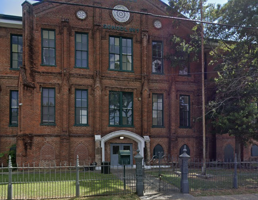
Designed by renowned architect William A. Freret, this stately brick edifice is one of the oldest remaining McDonogh schools; it currently houses Audubon in New Orleans. The School, building, has endured years of deferred maintenance. Citing the cost of renovation, the Orleans Parish School Board recently classified it as surplus property, sparking litigation from concerned neighbors. OPSB is reported to be negotiating a property swap with the Housing Authority of New Orleans. While New Orleans has several examples of schools converted into housing, the lack of specific plans and commitments from HANO has stoked concerns that the building could further deteriorate or be threatened with intentional demolition.

Belgian Paving Stones

Location: 600-800 St. Joseph Street, Lafayette Square

Threat: Disrepair and Lack of Maintenance

With a rough, durable surface that became disfavored with the emergence of automobiles, the mid-nineteenth century paving stones covering city streets were mostly paved over with asphalt in the early twentieth century. Called Belgian blocks, stones remained in place and served as foundational support for the new street surface. On only a handful of streets did the stones remain exposed, lending an undeniable charm and authenticity to the historic streetscape. St. Joseph Street from Baronne to Camp was among those few streets that managed to retain its exposed paving stone surface. Today, the paving stones are threatened by chronic neglect and years of construction projects along St Joseph Street.

425 Celeste Street

Location: 425 Celeste St., Lower Garden District

Threat: Demolition by Neglect or Full Demolition

This three-story Greek Revival-style storehouse stands as a lonely reminder of the importance of the riverfront area of the Lower Garden District in the economic development of 19th-century New Orleans. Today this significant circa 1865 commercial remnant faces several threats, the most immediate of which is demolition by neglect. Architectural details such as cast-iron columns are weathering and falling off, and several column capitals are missing. While cited as a contributing element to the National Register’s Lower Garden District, it does not fall within the Historic Districts Landmark Commission’s jurisdiction for local protection. A second threat to this building is that it will be consumed by the large-scale development planned in the immediate area.

Creole Cottage

Location: 5763 Dauphine St., Holy Cross

Threat: Demolition by Neglect and Blight Removal

City agencies have three times cited the owners of this circa 1880 Creole cottage in the Holy Cross Historic District for blight. Built in the rear of the former Charbonnet Plantation, the cottage was once part of a farming area. Owned by a single family for most of its existence, the cottage has little by little lost its family as generations died or moved away. The issue of joint or missing owners is a prevalent threat to homes in many neighborhoods. Recent city lines have increased the likelihood of demolition.

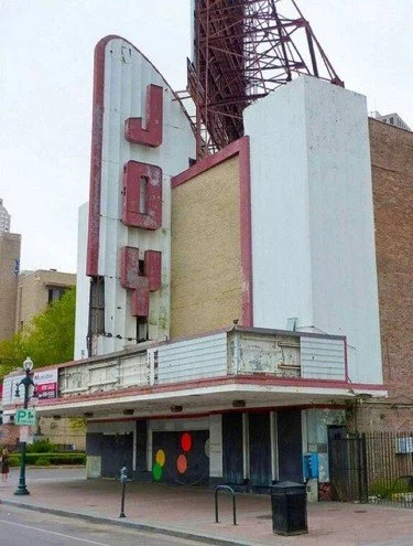
Neighborhood Theaters

Location: Citywide

Threat: Demolition by Neglect; Failure to Repurpose

The neighborhood theater, like the corner grocery, was once a familiar and welcoming sight throughout the city. Built before the development of television and the widespread use of the automobile, they were accessible on foot or by bicycle. These theaters were places where friends and families could meet and enjoy the latest Hollywood movies. Over time, changes in technology that allowed movie viewing at home or at multiplex theaters in area shopping malls, along with the migration of people from city to suburbs resulted in much reduced attendance. Consequently, most neighborhood theaters were closed and the buildings sold, with some demolished or left to decay, leading to the disappearance of a much loved institution.

 2018 New Orleans 9

Spanish Fort

Location: Bayou St. John and Lake Pontchartrain

Threat: Vandalism and Exposure

Fort St. John or "Spanish Fort" at the mouth of Bayou St. John is the location of fortifications that have existed from the earliest days of New Orleans to protect the city from attack by way of Lake Pontchartrain. The present fortifications were built by the United States in 1808, making the fort one of the oldest structures in New Orleans. Although placed on the National Register of Historic Places in 1982, the remaining brick ramparts continue to decline due to vandalism and exposure. Controlled by City Park, the fort forms no part of City Park's 2018 Master Plan. This remarkable link to the Bayou's earliest days will continue to deteriorate unless action is taken.

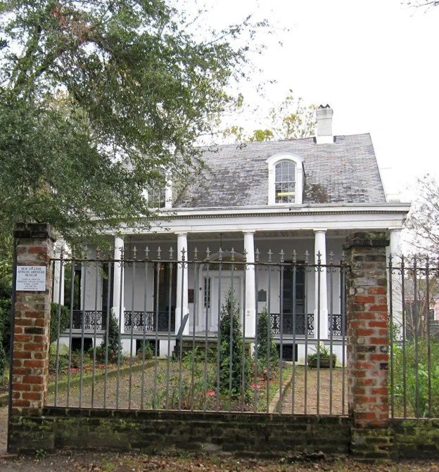
New Orleans African American Museum

Location: 1418 Governor Nicholls St, New Orleans, LA 70116

Threat: Demolition by Neglect

Located in Treme, the NOAAM includes seven historical structures on a former plantation site. The main building, the Meilleur-Goldthwaite House (1828-1829) is a raised center-hall cottage considered to be the finest remaining "master house" in the city. In 1991 the City of New Orleans purchased and restored the Villa Meilleur to establish the non-profit NOAAM. The museum's finances have always been unstable. Its future is clouded by controversy over misspent federal grant funds, an untimely purchase of another building needing extensive repairs, overall failed administrative planning and estimating, and bad luck. A successful capital campaign would return these historic structures to public use.

McDonogh No.11 School

Location N. Claibourne Ave.

Threat: Demolition by Neglect

Originally at Palmyra and S. Prieur, the 1878 three-story McDonogh No. 11 remains one of only a few schools by famed architect William Freret. Renovated in 1951, it later served as Priestly School of Architecture and Construction and the New Orleans Center for Health Careers. The stately structure was part of the 67-acre swath targeted for the new UMC and VA complexes. Decrying the absurdity of the just-spent $3M to restore it after Katrine, preservationists saved it from demolition. The state acquiesced, agreeing to move the building. Over two years, the state spent hundreds of thousands relocating it three times until it landed, isolated, in the interstate exit ramp curve in 2013. It remains on prominent public display, deteriorating.

Old Holy Cross School

Location: 4950 Dauphine St.

Threat: Demolition by Neglect

Built in 1895 by the Brothers of Holy Cross, this 4-story Italianate school is the sole remnant of the expansive campus that was abandoned after Katrina-related damage. Despite intense opposition, the City Council approved a 2014 redevelopment plan that would include two new 60-foot residential towers and the renovation of the former school. Neighborhood critics argued the project would overwhelm the surrounding community. Construction was announced for early 2016, yet today the handsome brick and cast iron structure stands untouched, choked with weeds and graffiti. The developers point to financial delays outside of their control, yet residents wonder if the long-stalled project will only hasten the decline of their neighborhood's namesake.

Rudolph T. P. Danneel School Caretaker's Cottage

Location: 5703 Annunciation St.

Threat: Demolition by Neglect

In the late 19th & early 20th centuries, custodial residences were often placed on school grounds. One such cottage is on the corner of Annunciation and Arabella, part of the uptown campus of the Ben Franklin Elementary School. This historic side-gallery shotgun may be older than the original Rudolph T. P. Danneel School c. 1908. In 2011, the Orleans Parish School Board recognized the "historic property," "deteriorated conditions," and its "blight to the surrounding neighborhoods." The Board voted unanimously to transfer this cottage to surplus and issue a competitive Request for Proposal for its sale and physical removal, but no action was taken. Seven years later, poorly secured, dangerously abandoned and still a public nuisance, this precious historic cottage needs a new and more responsible caretaker. Contact OPSB if it could be you.

Audubon Park Shelter 13

Location: 6600 Block of Magazine St.

Threat: Possible Demolition

The concept of Audubon Park as a fun destination rather than a place of quiet meditation emerged in the early 1920s. To serve this public use, park planners commissioned various attractions and structures, one of which is the threatened Shelter 13, designed in 1921 by architect Sam Stone, Jr., also president of the Audubon Park Commission. Stone drew plans for such local landmarks as the Masonic Temple and Maison Blanche. Constructed for restrooms in the busy Magazine Street area, Shelter 13 sits forbiddingly boarded up and fenced in. Current plans do not specify what will happen to this historic remnant, but possibilities range from converting it to a security station to demolition. Neighborhood advocates urge its renovation for public use.

Historic Lampposts

Location: Citywide

Threat: Demolition by Neglect

Neglected for decades, the damaged lamp stands along St. Charles Avenue and other local thoroughfares mar our picturesque streetscapes. The vast majority of the over 300 St. Charles Avenue cast iron streetlight stands have been left to rust, with missing trap doors, collars and collapsing bases. Some are missing entirely, the stubs of once beautiful lampposts ignominiously marked with orange cones. Installed about 1925 with their original rams' horn arcs at the top, the lampposts once provided the city with handsome and utilitarian street art. Today, owing to city and RTA neglect, they are literally falling apart.

Loew's State Theatre

Location: 1100 Block of Canal St.

Threat: Partial Demolition

One of the chain of theaters developed by movie pioneer Marcus Loew, the Loew's State Theatre in the 1100 block of Canal Street was hailed at its opening in 1926 as an "acme of grace and beauty." Designed by famed theater architect Thomas Lamb with more than 3,000 seats and an opera house style, this movie and vaudeville palace had the requisite opulence to showcase the top films of the then emerging Hollywood studios. The Loew's State, and the 1927 Saenger Theatre across the street, for decades served to establish Canal Street as the preferred destination for a luxury theater experience in the gulf south. Now threatened with the proposed construction of a high-rise hotel, this stately and dignified theater remains intact and awaits a proper restoration to return it to full functionality and service for years to come.

Civil Defense Control Center

Location: West End Boulevard

Threat: Demolition by Neglect

Deep below the wide neutral ground on West End Boulevard lies a relic of the Cold War. Opened in 1962, the Civil Defense Control Center is a subterranean bunker capable of shielding occupants from radiation in the event of nuclear attack. Radio and telephone equipment, medical supplies, and sleeping quarters were placed in rooms radiating out from a circular map room. Rescue and recovery efforts for Hurricane Betsy in 1965 were orchestrated there. The structure was shuttered in the mid-90s. The Civil Defense Center is a public building that has outlived its purpose, but hopefully will find a new use that recognizes its significance in our nation's history.

 2017 New Orleans 9

Historic Buildings in Louis Armstrong Park

Location: 701 N. Rampart St.

Threat: Demolition by Neglect

The National Park Service (NPS), FEMA, and the City of New Orleans play a part in the deterioration of the historic buildings in Louis Armstrong Park, including the Municipal Auditorium and the NPS Jazz Complex’s historic structures: Perseverance Hall, Caretaker’s Residence, Rabassa-DePouilly House, Reimann House and the Breezeway Building. Twelve years after Katrina, the City remains embroiled in negotiations with FEMA on funds to restore the Municipal Auditorium. Though the City recently secured the building to stop intruders, significant problems continue, such as holes in the roof that allow interior deterioration. The NPS Jazz Complex’s five historic structures in the park also suffer from neglect. The NPS lacks adequate funding, with a backlog of $12B in deferred maintenance projects nationwide. Congress should dedicate funding to maintain our national parks

Industrial Canal Communities

Location: Lower Mississippi River- Industrial Canal

Threat: Community Destabilization and Environmental Impacts

Still recovering from the levee breach after Katrina, the Ninth Ward and St. Bernard neighborhoods are now threatened by a 13-year infrastructure replacement project by the Corps of Engineers that includes the demolition of the 1921 Inner Harbor Navigation Canal (IHNC) Lock and St. Claude Bridge. Impacts to historic neighborhoods will be significant: dredging and transporting toxic materials, constructing new 24-foot flood walls, and destabilizing complex soils at the intersection of the IHNC and River - yet questions go unanswered. Added to these are traffic and bridge impairments for Orleans and St. Bernard parishes, an outdated environmental impact statement (1997), safety concerns, damage to buildings, resident relocations, reduced property values, and economic stagnation. The project benefits and economics are speculative, engineering vague, and adverse impacts abundant.

Israel M. Augustine School

Location: 425 S. Broad St.

Threat: Demolition by Neglect

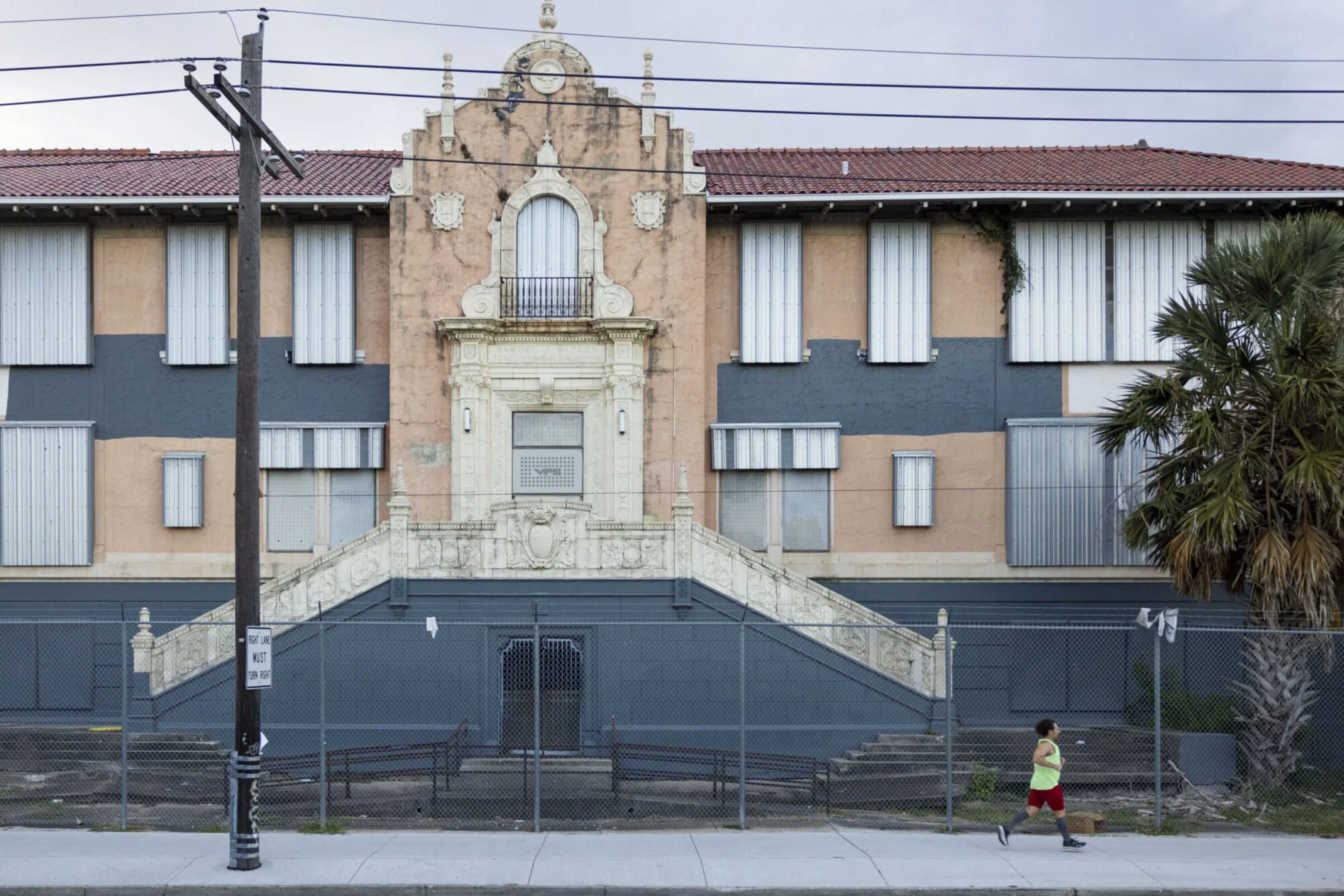
The Spanish Colonial Revival entry to Israel M. Augustine School presides over Broad Street near its intersection with Tulane Avenue. The balconette, escutcheons and red tile were added in 1927 to the circa 1913 building. Noted municipal architect E. A. Christy oversaw both the design and renovations of the school, originally named Samuel J. Peters. Today, the windows are shielded by metallic coverings installed when the Orleans Parish School Board opted to “mothball” the building post-Katrina. Hidden inside is one-of-a-kind artwork commissioned in 1931 by the Works Progress Administration, designed by Tulane watercolor instructor Leslie Powell and completed by Claire Silber. The series of thematic historic murals representing industry, power, finance, communication and transportation survived Katrina flooding and awaits restoration.

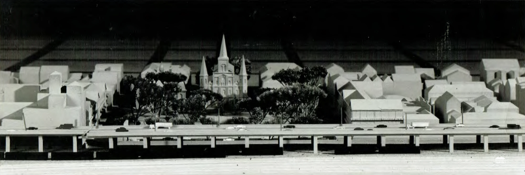
French Quarter Street Grid

Location: French Quarter

Threat: Loss of Historic French Quarter Grid

In 1721, the French engineer Adrien de Pauger arrived in the little settlement on the banks of the Mississippi River, then consisting of a few huts. Soon after, he drew a plan to impose order on this colonial outpost, using the grid pattern that dated back to Roman times. This “French Quarter Grid” has remained intact for almost three centuries, creating fluidity within this old neighborhood. This historic layout is now threatened by the “Citywide Security Plan,” which would close seven Bourbon Street blocks to vehicular traffic round-the-clock, even at intersections. The impact would be felt throughout the district, essentially stopping the flow of traffic and vitality in this living community. Temporary bollards may address safety concerns.

Oretha Castle Haley Elementary

Location: 2515 N. Robertson St.

Threat: Full Demolition

The former Charles E. Gayarre Elementary in the heart of the St. Roch neighborhood has sat vacant since the levee breach after Katrina inundated it with seven feet of floodwater. Built in 1921 by noted civic architect E. A. Christy in the early 20th-century Mediterranean Revival style, this three-story stucco and Spanish tile structure was auctioned as surplus school board property in 2013. Three years later, the owners applied for a full demolition permit to replace the building with a commercial “strip mall” development. The City Council denied that request in December 2016, encouraging adaptive reuse. The owners have since filed an appeal of that decision with the Civil District Court, continuing the risk for demolition.

Milneburg Lighthouse

Location: UNO, Elysian Fields, and Lake Pontchartrain

Threat: Demolition by Neglect

The Port Pontchartrain Lighthouse is the only remnant of the once vibrant 1830’s Milneburg port town and fishing village. This 1855 masonry structure replaced an original 1839 wooden lighthouse and remained in service until 1929. Originally 3000 ft into Lake Pontchartrain, it now sits dry on reclaimed land. Between 1939 and 1983, it was maintained by the Pontchartrain Beach Park development, featured on their midway. Acquiring the lighthouse in 1991 for its Research and Technology Center, the University of New Orleans assured its preservation. This has not happened. The bricks of the building are suffering major mortar loss, and vegetation appears in cracks. Much of the original ironwork is missing. The property is significant for its 159-year role in New Orleans history.

Luling Mansion

Location: 1438 Leda St.

Threat: Demolition by Neglect

The colossal mansion at 1438 Leda Street sits hidden from Esplanade Avenue. Originally sited on 30 acres, it was designed by James Gallier, Jr. in 1865 as a 22-room residence for cotton merchant Florence Luling. In 1871, Luling sold it to the Louisiana Jockey Club (1871-1905). Converted into apartments in 1934, it has been owned by the same family since 1950. The mansion progressively displays visible water damage and decay of its wooden brackets, soffit, and eaves from lack of basic maintenance. The original wooden balcony balustrades were insensitively replaced many years ago with one-sided aluminum castings. If these current wooden elements are not cared for, they too may be lost, further diminishing this grand, Renaissance palazzo-style landmark.

St. Claude Pharmaceutical Building

Location: 2337 St. Claude Ave.

Threat: Demolition by Neglect

An eagle still stands guard above the doorway to the neoclassical building designed in 1926 by eminent architect Emile Weil as the St. Roch Market Branch of Whitney Bank. Ornate capitals, embellished with urns, top the pilasters, but below, graffiti scars the exterior at street level. Rot threatens the large multistory windows, decades of air pollution stain the cornice, and stone masonry is deteriorating. Home for decades to the Louisiana State Pharmaceutical Association, the building more recently served as an art studio. As of now, the commercial renaissance along St. Claude Ave. has bypassed this handsome structure, but the success of nearby adaptive reuse projects like St. Roch Market and the New Orleans Healing Center point to its latent potential.

20th Century Service Station

Location: 3420 Washington Ave.

Threat: Demolition by Neglect

Early in the 20th century, a new demand arose from the mass production of the automobile: the need for neighborhood fueling stations. Built for the Gulf Oil company, circa 1930, this early filling station is a rare example of transitional design from Craftsman style toward a more contemporary, Prairie School style, exemplified by its large cantilevered canopy supported on a single masonry column. Blighted and neglected, it stands decaying and overgrown with vegetation; yet it can be saved. Retaining its unique original green glazed tiles, unpainted masonry walls, original wood windows, and broad canopy with details intact, if restored, it will provide a window into the early 20th-century era of mobility and convenience in New Orleans.

 2016 New Orleans 9

Parks & Open Spaces

Location: Citywide

Threat: Privatization, specialization and commercialization

The recent controversies over a proposed soccer complex at Audubon Park's "Fly" and a golf course in City Park illustrate the increasing threat of privatizing, specializing, and commercializing public spaces in our city. Our public parks are increasingly being devoted to commercial and single-use, limited-admission facilities. These facilities infringe on people's interactions with nature in unscripted ways, the primary purpose of urban parks. Furthermore, because limited admission and commercial facilities are available only to those who can afford the price of admission, they harken back to the days when access to public places was denied to many. A simple solution is to make new facilities in parks Conditional Uses (CU) subject to review by the Planning Commission and approval by the City Council, opening the merits of these facilities to broader public discussions where alternate locations could be considered. Our public parks and open spaces are an integral part of our cultural and historic landscape and must be kept free and open for future generations.

1505 St. Bernard Ave.

Location: 1505 St. Barnard Ave.

Threat: Owner requested demolition and neglect

Built in 1927, this blighted and neglected two-story masonry building is one of the few remnants of a once thriving neighborhood business district surrounding the former St. Bernard Market (now Circle Food Store). Its ground floor held the Hart Jewelry Co. (1930-1950s) and later the African American-owned Keystone Life Insurance Co. The second floor was used for an African American branch of the YWCA in the 1940s. In 2011, TAG Businesses LLC acquired the building through a bargain price program that required renovation in 270 days. Five years later, the owner has done nothing but allow further decay and even recently requested its demolition. With numerous code enforcement violations/liens, prolonged neglect, and the owner's apparent lack of understanding of the building's historic or contextual importance, the city has the right and obligation to revoke this sale and sell to a more responsible developer.

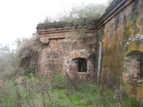
Fort Macomb

Location: Chef Menteur Pass

Threat: Demolition by neglect

In the wake of the War of 1812, Congress commissioned Fort Macomb to guard the Chef Menteur Pass into Lake Pontchartrain as part of an ambitious seacoast defense plan. Decommissioned in 1871, this historic site has remained for decades as abandoned ruins choked by weeds, further compromised by rising waters in 2005 during Hurricane Katrina. Named to the National Register of Historic Places in 1978, the fort is owned by the State of Louisiana, which evidently has neither the financial capability nor intent to care for this national treasure. Closed to the public, the fort was leased for filming in 2014 (HBO), 2015 (AMC), and in 2016 (Beyonce's video). If the state cannot address the rapidly advancing deterioration of the brick skeletal remnants, it should allow the intervention of more capable federal or private stewardship.

636 Royal St.

Location: 636 Royal St.

Threat: Demolition and neglect

This imposing town house, one of the city's few remaining structures from New Orleans' Spanish colonial period, has significant structural issues. Located at the highly visual corner of Royal and St. Peter Streets, the Pedasclaux-Lemonnier House - renowned as the city's "First Skyscraper," and immortalized in literature as George Washington Cable's "Sieur George's" - figures as an integral component in the ensemble of late 18th-century buildings in the Jackson Square area. Inside, the oval second story drawing room is perhaps the most well-appointed space in the city. The Vieux Carré Commission has cited the owners of the building on numerous occasions for neglect, even filing a suit in 1988 in the Civil District Court for Demolition by Neglect. For the past forty years the house has been in the hands of the same family who, so far, have refused to do what is required to properly care for this grand landmark.

468 St. Joseph St.

Location: 468 St. Joseph St.

Threat: Demolition by neglect

For decades, this once elegant Greek Revival townhouse has steadily deteriorated in the rapidly developing downtown Warehouse District. For over twenty years, the Historic District Landmarks Commission has cited the property owners for allowing the property to deteriorate by neglect by not repairing the roof, millwork, gutters, masonry, and etc. Constructed for the Voisin family in 1846, according to the design of architect B.F. Nicholls, this was the home in the 1860s of banker Jean Baptiste Voisin. This property is located in a highly visible location in one of the city's most popular neighborhoods. If the long-term owners do not wish to maintain this fine three-story residence, it should be offered for public sale.

Bywater Neighborhood

Location: Bywater

Threat: Exploitative tourism

For over two centuries, Bywater has been a community of working-class families. The small-scale character of the neighborhood today is threatened by proposed out-of-scale development, with the impact of traffic overwhelming its narrow streets. The 2010 Master Plan for New Orleans Tourism established the goal of doubling the annual number of visitors by 2018. Since then, the tourist sector has rapidly expanded beyond the Vieux Carré into the surrounding historic neighborhoods. Bywater today is being "reinvented" as a tourist destination with plans for a megacruise ship terminal, high-density vacation condominiums, hotels/hostels/short term rentals, tourist-oriented retail, and riverside condos that will wall off the community, without regulations similar to what protects the French Quarter. Planned developments for Bywater are a vivid illustration of the conflict between maintaining community values and the demands of tourism.

Fountain of the Four Winds

Location: Lakefront Airport

Threat: Deterioration and neglect

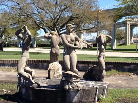
Fountain of the Four Winds, one of Enrique Alférez's most extraordinary works, caused controversy after its 1936 installation at Shushan (today's Lakefront) Airport. Funded by the WPA and composed of concrete aggregate, hand-finished to resemble sculpted sandstone, the fountain features four nude kneeling figures surrounded by an elliptical base adorned with statuary and reliefs. Legend has it that Alférez stood guard with a rifle until Eleanor Roosevelt stepped in demanding protection for the work. Today, it is threatened differently. Already in disrepair, the fountain was further damaged during Katrina. Some rim elements were displaced, and saline incursion infiltrated the porous material, continuing to cause fissures and erosion. With the award-winning restoration of the Art Deco terminal and the ongoing conservation of the interior Xavier Gonzalez murals, the restoration of the Four Winds would complete the artistic tout ensemble.

New Orleans Monuments

Location: Citywide

Threat: Removal

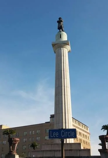
The public monuments of New Orleans, an inherited legacy from our ancestors, commemorate our city's 300-year history. Preservation of these iconic markers is not reverence, but a challenge to learn more about and to seek accommodation with our city's complex and diverse history. That challenge can be met by contextualizing and thoughtfully expanding the narratives offered by those monuments. Recently, a flawed public process that sought to pass judgment on history through a contemporary lens resulted in a city council vote for the removal of four monuments. Since then, calls have suggested removal of many more. This represents a slippery slope that should be rejected. The divisive rhetoric generated by this process, combined with neglect and indifference to the value and beauty of these artifacts and of their contributions to the urban streetscape, needlessly exposes the monuments to the vagaries of man and nature, and represents ill-formed, ad hoc public policy.

2501 St. Claude Ave.

Location: 2501 St. Claude Ave.

Threat: Owner requested demolition and neglect

At first glance, one sees a sad remnant of a late 19th century camelback shotgun; but behind the graffiti and boarded-up windows, there is still a renovation opportunity for the historic St. Claude community. When the City Council approved its demolition, submitted by two high-profile New Orleanians to expand their gas station enterprise, neighbors opposed loudly. Their concerns finally resulted in a lawsuit. Details within that suit challenge ownership by alleging that New Orleans Redevelopment Authority inappropriately pulled the property from a sheriff's tax sale in 2012. This "priority bid" process placed it directly into the hands of private citizens for well below what other potential purchasers were prepared to bid. Additionally, neighbors cite the blight fines totaling more than $120,000 as evidence of poor stewardship of a historic resource. The active lawsuit has placed a temporary halt on the demolition of this classic structure, integral to the neighborhood.

 2015 New Orleans 9

Former New Orleans and Carrollton Railroad Powerhouse

Location: 403 Napoleon Ave.

Threat: Demolition by Neglect

A masterpiece of late 19th-century American industrial architecture, the masonry power station located at the corner of Tchoupitoulas Street and Napoleon Avenue, designed by New Orleans-based architect Thomas Sully, was built in 1892 for the New Orleans and Carrollton Railroad Company. It was originally constructed to house turbines that converted water drawn from the nearby Mississippi River and artesian wells for the production of steam used by the railroad. While no longer used for its original function – it is reportedly still used by the Regional Transit Authority – this building is characteristic of Gilded Age commercial design that should be preserved. Potentially dangerous conditions urgently needing structural and masonry repairs are being ignored.

Fort Pike

Location: 27100 Chef Menteur Hwy.

Threat: Deterioration, lack of repair

Fort Pike, located at Pass Rigolets, was the first fort designed and constructed as part of the United States’ Third System of coastal fortifications and was considered the most strategically significant fort for the protection of the country. Fort Pike was completed in 1826 and saw action during the Seminole Wars, the Mexican War and the Civil War before being decommissioned in 1890. The fort’s waterside location made it ideal to protect New Orleans, but is now contributing to its endangerment. In addition to acute damage from recent hurricanes, less obvious problems such as wave action, rising damp and uneven soil settling are threatening the stability of the fort.

924 Euterpe

location: 924 Euterpe

Threat: Demolition by neglect

This is a fine example of a c. 1860-66 Greek revival double-galleried house, exemplary for its Lower Garden District location. Between 1866 and 1891, its owner and likely builder was Jeremiah Lincoln, a Maine native and proprietor of a local house raising company. When featured in the Friends of the Cabildo’s The Lower Garden District(1971), the building was still in relatively good condition, with its cast iron fence intact. Since 1980, however, the property has suffered from owner neglect. Numerous permits have been issued and fines levied by the Historic District Landmarks Commission, but no substantial improvements have occurred. Today extreme deterioration continues. Especially of concern is the gallery cornice which appears on the brink of collapse, endangering the adjacent picturesque cottage at 916 Euterpe.

518 Eleonore

Location: 518 Elenore

Threat: Owner requested demolition and neglect

Largely obscured by overgrown trees and shrubbery, this c. 1860 galleried Creole cottage is the object of an unnecessary demolition request by its owner, a Nashville Avenue resident who purchased the house in November and plans to build a larger building on the lot. The home, a rare survivor of the antebellum period in old Hurstville, is in wholly repairable condition. A Creole cottage with classic floor plan and attached wings, it was built sometime after the 1858 purchase of the entire square by Francis Thomas, a butcher in the old uptown market between State and Eleonore Street. The family resided in the cottage until 1890. The loss of this scarce link to the early days of Uptown would be irreparable.

Carrollton Courthouse

Location: 701 S. Carrollton Ave.

Threat: Deterioration, potential demolition and inappropriate development

The Carrollton Courthouse was designed by the renowned architect Henry Howard. It once served as the Jefferson Parish seat of government and later housed various public schools. Today, the courthouse is the iconic architectural symbol of Carrollton. When the School Board sought in 1950 to raze the courthouse, a coalition of Carrollton residents and the newly-formed Louisiana Landmarks Society succeeded in saving it. Vacant since 2013, the courthouse could be auctioned to the highest bidder according to School Board plans. Because the courthouse is not a legally protected historic building, there is the possibility that it could even be demolished.

Marsoudet-Caruso House

Location: 1519 Esplanade Ave.

Threat: Deterioration

In its 1977 New Orleans Architectural Series, the Friends of the Cabildo noted that this formerly elegant 1846 center-hall American cottage stood alone among commercial uses and vacant lots. The house was constructed for Mrs. Eliza Ducros Marsoudet by builders Nicholas Duru and Jacques Michel St. Martin. Still impacted by its environment and the nearby elevated interstate, the house has struggled to survive. In 2010 the future of the house was given new hope when Saint Anna’s Episcopal Church purchased the property in a lease-purchase agreement with the goal of turning it into a community center--Dodwell House--to expand their existing outreach programs. However, now the church is greatly challenged to raise funds to stabilize the building.

S. W. Green Mansion

Location: 2501 Banks St.

Threat: Demolition by neglect

Son of a former slave, Smith Wendall Green made his fortune as a grocer and then as president of Liberty Independent Insurance. A delegate to Republican National Conventions and international officer of the Colored Knights of Pythias, Green was largely responsible for the 1909 construction of the Pythian Temple, an African American landmark, currently under renovation in the CBD. Weiss, Dreyfous & Seiferth, architects for Charity Hospital and the State Capitol, designed Green's 1928 Craftsman-style, 17-room mansion on S. Miro. Partially burned by the KKK during construction, it nevertheless became a symbol of African American achievement. “Discovered” in the footprint of the proposed VA hospital by preservationists, the privately-owned mansion was moved with help from VA and the City across Rocheblave from the new medical complex, where it sits in disrepair.

New Orleans Riverfront

Location: St. Thomas, Lower Garden District, Marigny, Bywater, Holy Cross, Algiers Point

Threat: Out-of-scale and incompatible development

Written public comments to the City Planning Commission suggest that 98% of the public wants to keep longstanding height limits for the city’s historic neighborhoods. Nevertheless, the recently approved Comprehensive Zoning Ordinance (CZO), the final step in the city’s years-long Master Planning process, calls for additional height allowances either by changing the zoning map or applying an “overlay district” along the Mississippi River, allowing structures to qualify for a “height bonus” of 25 feet. A 50% increase in heights to 75 and 80 feet along the river would be permitted if developers use certain design elements. Neighborhoods fear a loss of historic “sense of place” and scale if mid-rise towers are introduced in century-old neighborhoods.

Touro Shakspeare Home

Location: 2621 General Meyer Ave.

Threat: Demolition by neglect

The Touro Shakspeare Home in Algiers was constructed in 1933 as a municipal almshouse. Designed by local architect William R. Burk, the building combines elements of both Neo-Classical Revival and Jacobethan Revival styles, and is particularly notable for its diamond-patterned polychrome brickwork, symmetrical massing, stepped parapets, and prominent front portico. The institution, named for philanthropist Judah Touro and former mayor Joseph Shakspeare, functioned as a city-owned nursing home until 2005. Vacant since Hurricane Katrina, the building has deteriorated significantly in recent years. Despite the continued neglect, it appears that the distinctive structure still retains many original exterior features and could be renovated either by the City of New Orleans (the current owner) or a private developer.

 2014 New Orleans 9

Potential loss of Federal Historic Tax Credits

Location: Citywide

Threat: Possible elimination

The Federal Historic Rehabilitation Tax Credit, which gives developers a tax credit worth 20 percent of qualifying restoration expenses for historically-appropriate renovations of buildings 50 years or older, is at risk. This poses a threat to the revitalization of historic buildings across the country. The credit has been under fire many times over its 30-plus year existence. There is one proposal in Congress to totally eliminate the tax credit, while another calls for reducing the tax credit by half. The majority of larger historic buildings restored in the past three decades have been restored because the tax credit has made the projects financially feasible. Should there be any reduction or elimination of federal tax credits, the impact upon New Orleans’ growth and economic vitality would be dire.

1500 Gov. Nicholls

Location: 1500 Gov. Nicholls

Threat: Lack of effective code enforcement

1500 Gov. Nicholls, at the corner of N. Villere in Tremé, is a19th century 2-story corner store with a detached 2-story residence in the rear. This historic building is vacant and blighted, with $20,000 of city liens and blight judgments dating to 2011 and earlier. Still, it remains open to the elements without abatement or attempt to remedy. This dilemma is similar for many structures throughout the city. The January 14, 2013 - City of New Orleans Code Enforcement Update offers an eleven-step lien foreclosure process for blighted buildings, but the city does not follow this process. The city must begin to follow a clear, consistent path toward the goal of resolving blight for historic buildings to prevent their loss.

New Orleans Master Plan

Location: Citywide

Threat: Lack of sufficient planning staff and insufficient public understanding of planning process

A 2008 City Charter change required New Orleans to create a Master Plan with the force of law to direct the future development of the City. The new Master Plan was adopted in 2010. Now, by law, all land use regulations, including zoning and capital expenditures, are required to be consistent with the Plan. However, the Master Plan is threatened because the Planning Commission does not have enough staff to successfully operate the planning process, and citizens generally do not understand how the new planning process functions and why it is advantageous to the community. For the Master Plan to function in a responsible manner, public funds must be appropriated to hire additional city planners, and the public must be educated about the value of the Plan to the City.

Historic Holy Cross District

Location: Holy Cross

Threat: Out of scale development

A recent proposal to redevelop the former Holy Cross School site that is out of scale and character threatens the National Register Historic District with two 60’ five-story apartment towers imposed in the center of a neighborhood of single-story historic homes. The residents have voiced consistent opposition to the recently approved height of 60’. The proposal, with the drastic zoning change sought, is of much greater density and height than the 40’ previously permitted in the historic district. If built, this development will profoundly and adversely affect the historic neighborhood and set a precedent for others.

7214, 7300, and 7320 St. Charles Avenue

Location: Uptown

Threat: Special exemption from local landmarking

Greenville Hall, at 7214 St. Charles Ave. is an Italianate double gallery structure built for the Dominican nuns in 1882. 7300 St. Charles Ave. is a unique stone mansion designed for Peter Fabacher in 1907 by Toledano and Woogan. 7320 St. Charles Ave. is a Gothic residence built for Moise Levy, Jr. in1913. In 2012, the state legislature passed a bill sponsored by Representative Walt Leger that carved out a special exemption from local historic landmarking for particular properties along St. Charles Avenue owned or controlled by Loyola University. Any protection that the Historic District Landmarks Commission could have offered was eliminated by the passage of this bill, leaving these buildings on St. Charles Avenue between Broadway and Lowerline extremely vulnerable.

422 Canal Street, and 105, 109, and 111 Tchoupitoulas Street

Location: Central Business District

Threat: Demolition

These buildings near the corner of Canal and Tchoupitoulas were all built circa 1840. These historically significant buildings are at risk due to the proposed development of a 21-story hotel on the site of these structures and on adjoining vacant properties. The Historic District Landmarks Commission denied the developer’s request to demolish these buildings, and the developer appealed the decision to the City Council. The loss of this particular set of historic buildings would be considerable. Any new development must preserve these historic buildings and appropriately respect them in scale and relationship.

2517 Jackson Avenue

Location: 2517 Jackson Avenue, Central City

Threat: Demolition

Built in 1873, 2517 Jackson Avenue was the home to Wesley United Methodist Church in the 1950’s, the eighth-oldest African American church in the nation and the second-oldest in New Orleans. Wesley Church was established on South Liberty Street in 1838. This building served as a hub for the civil rights movement, and Dr. Martin Luther King Jr. spoke in Wesley’s upstairs chapel. Now vacant, this solid historic masonry structure is a precious element along Jackson Avenue, representing both the history and community of Central City. Members of the community have indicated their concern that the building will be demolished for a parking lot. Work had begun to restore the building for use as a community center.

Semmes Elementary

Location: 1008 Jourdan St.

Threat: City’s failure to force correction of violations

Semmes Elementary School was built in 1900. It has been privately owned since 1985 and has remained vacant since Katrina. While most of the surrounding historic Holy Cross neighborhood is rebuilt after the storm, this building and its grounds remain a blighted public nuisance. Judgments and fines for blight have been placed upon the building by City Code Enforcement as recently as 2013, yet it appears that each time the fines were paid without the owner addressing the violations. The intent of fines and potential lien foreclosure is to motivate property owners to act responsibly for the health, safety and welfare of the public; therefore, blight fines should not be allowed to be paid without forcing the owner to correct the violations.

Corner of Esplanade Avenue and North Rampart Street

Location: French Quarter

Threat: Inappropriate development

The 85-block French Quarter (Vieux Carré) is our oldest National Register Historic District and still reflects the original city plan from 1721. The uptown river corner at North Rampart Street and Esplanade Avenue is its gateway and the edge to its fragile and dwindling residential sector. Currently, this corner consists of several vacant properties poised for development. The latest proposal called for the re-subdivision of three lots, consolidation of open spaces, perpetuation of an illegal billboard, and operation of an out-of-scale restaurant venue. Persistent diligence is required to ensure that any redevelopment of this invaluable corner is sensitive to residents and embodies the unique historic character of the City’s oldest sector.

 2013 New Orleans 9

World Trade Center

Location: Central Business District

Threat: Demolition

The World Trade Center (WTC) building was designed in the 1960’s by Edward Durell Stone, one of America’s most prominent 20th century architects. A distinctive structure in the city skyline, the city-owned WTC building is in danger of being demolished even though it is perfectly serviceable and capable of being redeveloped. Two self-financed proposals have been presented to redevelop the building and both would generate income for the City. Destruction of this building would mark the loss of one more piece of mid-twentieth century architecture from the fabric of the city, echoing the loss of the Rivergate and other mid-century edifices.

Choice Neighborhood Initiative Area

Location: Treme, Esplanade Ridge, Mid-City, 7th Ward

Threat: Large-scale redevelopment

In addition to redeveloping the Iberville public housing site, the Choice Neighborhood Initiative will develop over 2,400 market and subsidized housing units in the historic Creole heart of New Orleans. The boundaries, Rampart Street to Broad, Tulane Avenue to St. Bernard, include areas of Greater Tremé, Esplanade Ridge, Mid-City, and the Historic 7th Ward neighborhoods, which have struggled successfully to recover after Katrina. The City and Housing Authority must take care to ensure that the development of the housing units, along with subsequent commercial endeavors, are sensitive to the historic community and living culture of this area.

Canal Street Ferry Service

Location: Central Business District & Algiers

Threat: Loss of transportation route

The first regularly scheduled ferry service between Canal Street and Algiers was established by the Louisiana Legislature in 1827. Today the ferries carry more than 1.1 million passengers a year. 2012 legislation transferred control of the ferries to the Louisiana Department of Transportation and Development, and an attempt to privatize the ferry system failed when no companies bid for operations. A bill recently signed by the Governor opens the door to possible operation of the ferries by the New Orleans Regional Transit Authority, but many issues remain unresolved.

St. Louis Cemeteries No. 1 & 2

Location: Treme Neighborhood

Threat: Potential damage from Iberville Redevelopment

St. Louis Cemetery No. 1 (c. 1796) is the oldest existing cemetery in New Orleans. Along with St. Louis Cemetery No. 2 (c. 1823), they are owned and operated by the Archdiocese of New Orleans. The cemeteries represent the early history of New Orleans, and are the final resting place of many prominent New Orleans families, particularly from the Creole population. Already in a fragile condition, the cemeteries are now threatened by the construction impacts from the impending demolition and reconstruction of the Iberville Redevelopment Project, located adjacent to both cemeteries. Extraordinary precautions must be taken to protect and preserve these extremely historic and highly visited sites before any work begins.

1347 Esplanade Avenue

Location: 1347 Esplanade Avenue

Threat: Demolition by neglect

This late nineteenth century Italianate Greek Revival style cottage attests to the era when elegant homes were built along the avenue by Creoles, many of whom left the French Quarter or moved into the city after the Civil War. Long dilapidated and slowly perishing, this proud house suffered a fire on Easter Sunday of 2013 that demolished the roof. Rain now freely pours into this irreplaceable building, causing further damage. Anchoring a prominent corner of Esplanade, this building cannot afford to be lost.

1828-30 Baronne Street

Location: 1828-30 Baronne St.

Threat: Demolition by neglect & insufficient protection for Landmark Buildings

1828-30 Baronne Street is one of two Italianate double gallery duplex residences built side by side shortly after the Civil War. The HDLC has given these buildings Landmark designation, rating them of major architectural importance. The house is important as one of a unique pair of historical buildings, as well as contributing to the fabric of the Central City National Register Historic District. Neglect by the current owner has left the house in a state of serious decline. Action by the city could save this property. Since this property is adjudicated to the city for nonpayment of taxes, it qualifies to go to tax sale, a solution which could ultimately preserve this building.

Blighted Occupied Residences

Location: Citywide

Threat: Demolition by neglect & lack of code enforcement on occupied properties

The presence of blighted properties has long been a pressing issue for New Orleans. While we often think of these properties as uninhabited, many are occupied. The city is currently rewriting the City Code in order to address occupied blight, but the solution is as complex as it is varied. An occupied home should not be lost to a city authority because the owner does not maintain it to government standards. Only proactive solutions that first stabilize a blighted residence can address the most complex cases while still respecting constitutional property rights. The city must strive to support homeowners while preserving the historic built environment of our neighborhoods.

Live Oak Canopy

Location: Citywide

Threat: Damage from public works projects

The sight of shaded streets gracefully lined with live oak trees is indicative of New Orleans. From the destruction of the longest line of live oaks in the nation for the construction of the Claiborne Expressway, to drastic trimming for power lines, live oak trees are frequently butchered or removed for public works projects. A recent example includes the branch mutilation and root damage suffered by trees aged 100 years and older on Napoleon Avenue in spring 2012 as the boulevard underwent a drainage system overhaul. The trees are also cut in order for the Corps of Engineers to get large cranes down the street, rather than using folding cranes with a lower travel height. It will be decades before the trees recover, and we will lose much of the scenic character of the city in the process.

1831 Polymnia Street

Location: 1831 Polymnia St.

Threat: Demolition by neglect

1831 Polymnia Street was originally built as a school in the 1880’s, and today it is designated as a Landmark building of local architectural importance by the HDLC. Due to neglect this vacant and uninhabitable three story masonry structure is quickly becoming a public safety hazard. This building has visible holes in the roof and is completely open to the elements, with a street opening accessible to vagrants. The owner has received permits for a $4.8 million dollar, 13,000 square foot historic renovation approximately 100 feet away at 1731 Baronne, but no plans have been submitted to renovate or even stabilize 1831 Polymnia St.

 2012 New Orleans 9

1201 Baronne St./ 1810 Clio St.

Location: 1201 Baronne St./ 1810 Clio St.

Threat: Legal quagmire precedent leading to neglect.

This important, renovated corner store lingers in legal limbo. Local landmark status was awarded in 2004 and it is one of the few remaining 19th century corner store buildings in Central City. The property was purchased in deplorable condition at a tax sale and extensively rehabilitated. In the course of the project, however, the state law that permitted one to purchase and upgrade a property was changed, possible allowing the original owner to reclaim the property without reimbursing the renovator for his costs. The old law encouraged preservation through private action; however, the new law (RS47:2161) makes future protection unlikely. Today, run-down historic properties that have tax liens will face demolition through neglect.

Armstrong Danna House

Location: 2805 Carondelet St.

Threat: Neglect

This striking Italianate mansion, listed as a local landmark with highest (“purple”) rating and even cited in Wikipedia as an example of Italianate architecture in the U.S., is desperately in need of care: the masonry needs tuck-pointing; cracks are showing between first and second story windows; upper and lower gallery floors are cupping; shutters are rotting; iron work is in need of reconditioning; foundations need careful attention; some historic architectural components are missing. This building has continued to decay due to neglect for many years.

220-1300 Bourbon St.

Location: 220-1300 Bourbon St.

Threat: Excessive noise, overcrowding, neglect

Seventeen French Quarter buildings rated nationally important are threatened with excessive noise vibration, overcrowding, structural neglect, and the loss of historic fabric. The buildings range from late 18th century through mid-19th century. Careless proprietors are causing damage not only to the buildings they occupy, but also to the street and neighborhood as a whole. The situation demands a holistic approach to enforcement. The City and the courts must ensure that businesses on Bourbon Street follow the rules established by the City and the Vieux Carré Commission.

City Park Maintenance Building

Location: No 1. Palm Dr.

Threat: Demolition by neglect

Designed by architect Richard Koch and built by the WPA in the 1930s with historic bricks from the demolished 1831 Tremé prison, the City Park maintenance complex is approaching a state of no return. At some point reconstruction will not be economically feasible. Prior to Hurricane Katrina the complex building was in need of extensive repairs; since Katrina the building’s damage has accelerated. Portions of the main roof and exterior walls collapsed and have been open to weather conditions since the storm.

U.S. Public Health Hospital

Location: 210 State St.

Threat: Neglect, future development

This historic campus was originally the plantation brickyard of Polycarp Fortier and dates to 1830-1850. An important but deteriorated antebellum cottage on the side near Tchoupitoulas dates to the plantation era. The site was converted in the 19th century to a US Marine Hospital. It also contains a historic brick wall which is on the National Register, and a Director’s home facing the river. The domed, pentagonal early 20th-century Naval hospital forms the principal hospital structure; Other Physicians’ quarters are now over seventy years old. The entire site is now threatened by neglect and the possibility of sale to private hospital interests without any preservation covenants.

Kenner High School

Location: 1610 Third St., Kenner, LA

Threat: Demolition by neglect

One of Kenner’s few architectural landmarks, this National Register building sits empty and unused. It has been featured as a Historic American Buildings Survey site as well as on the Historic American Engineering Record. Although showing the marks of time, this Classical Revival Style building designed by William T. Nolan maintains its original charm. If renovated it would help contribute to the quality of life in Kenner and serve as an anchor for further development within the Historic Kenner area.

Odd Fellows Rest Cemetery

Location: 5055 Canal St.

Threat: Neglect

Founded by the benevolent society of the International Order of Odd Fellows (I.O.O.F.) in 1831, Odd Fellows’ Rest is one of oldest and most beautiful cemeteries in New Orleans. Today it is an “orphan” cemetery, needing care and ownership. According to Save Our Cemeteries, there is but one elderly member of the New Orleans chapter alive. The historic property needs a permanent source of funding, a new legal caregiver such as Save Our Cemeteries, or adoption by the State for its maintenance.

Sexton Cottages

Location: Citywide

Threat: Demolition

Lafayette Cemetery No. 1, Lafayette Cemetery No. 2 and Holt Cemetery Sexton cottages are in imminent danger as the City of New Orleans has proposed their demolition and replacement with masonry structures clad in artificial wood siding. Louisiana Landmarks Society, working with other preservation organizations, has proposed lower cost alternatives that preserve their structural integrity while supporting the maintenance function. The structures are the last examples of 19th century cemetery cottages and their unnecessary loss would be tragic.

Houses Moved From VA/ University Hospital Site

Location: Mid City

Threat: Demolition by neglect

Dozens Of houses moved from the Veteran Affairs Medical Center and University Hospital sites sit roofless, unallocated, and open to the weather. Of 165 contributing historic homes, approximately 84 were moved in what was likely the largest house-moving project in the U.S. While dozens of the houses were put on a track toward rehabilitation, many of the houses are in no better condition today than they were on the day they were moved. The house moving effort could have been a national model for saving historic homes and infilling historic neighborhoods, instead many homes now sit exposed and deteriorating.

 2011 New Orleans 9

Buddy Bolden House

Location: 2309 First Street

Threat: Demolition by neglect

The Greater St. Stephens Baptist Church owns this late nineteenth century double shotgun cottage that was the family home of Charles “Buddy” Bolden, one of the founders of jazz. It was recently cited by the Historic District Landmarks Commission for demolition by neglect. New Orleans is dotted with landmarks that track jazz history. Especially now, many are threatened as the city pursues its demolition policy for blighted and vacant residences. The city should recognize their historic, cultural, and economic value as connectors to jazz history.

Hubbell Library

Location: 725 Pelican Avenue

Threat: Demolition by neglect

Making a rare second appearance on the list, this historic Carnegie library is still in jeopardy despite enormous community support for its reopening. The 104-year-old library mainly sustained roof damage during Hurricane Katrina, and although it reopened in October 2005, it has been closed since May 2008 after city inspectors deemed the roof in imminent danger of collapse. To date no new library has been built near Algiers. Instead of directing funds to building new “storefront” (glass and steel) style libraries, members of the community would prefer to see this library restored and updated.

Abandoned and Neglected Public School Buildings

Location: Citywide

Threat: “Mothballing,” neglect, fire, demolition, citywide.

Facing shifting populations after Hurricane Katrina, the Orleans Parish School Board shuttered, or “mothballed,” schools instead of using FEMA repair money granted specifically for that school. Many have architectural importance, such as Phillis Wheatley School’s internationally recognized mid-twentieth century design. McDonogh #19 (pictured) was the first city school to integrate in 1960, a significant role during the Civil Rights Movement. The School Board should continue to auction these properties or consider creative adaptive reuse.

Shotgun Houses on Mayor's Blight List

Location: Citywide

Threat: Demolition by the City, citywide.

Beginning in the 1840’s, shotgun houses continue to be the vernacular residence of choice in New Orleans. Across the city, they reflect a textbook of architectural styles including Greek Revival, Eastlake Victorian, Bracketed Victorian, Italianate, Colonial Revival and Craftsman. In addition to aesthetics, shotguns are valued for their sustainable materials, their adaptability to renovation, and for their affordability for first-time homeowners. To make way for the LSU and VA hospital complex, shotguns are being demolished, decreasing their ubiquitous presence in the fabric of the city. Many are on the Mayor’s Blight Reduction List and slated for demolition.

Lustron House

Location: 49040 St. Roch

Threat: Demolition

The Lustron Corporation produced prefabricated homes to satisfy the post World War II housing demand. According to FEMA and the Louisiana State Historic Preservation Office, this house’s original condition qualifies it for National Landmark status. It retains enameled steel exterior panels, built-in cabinets, and interior paneling. Only a handful of these remain in the city. The Louisiana Land Trust auctioned the house recently, but the new owner has applied for its demolition.

Valence Cemetery

Location: Valence Street between Daneel and Saratoga Street

Threat: Demolition by neglect

The Valence Cemetery was laid out in 1867 to serve the city of Jefferson, a suburb incorporated into New Orleans in 1870. Owned and operated by the city, the cemetery receives no maintenance. Tombs and copings are disintegrating from root damage and vegetation growth. Some of the vaults are open and empty, sending a disgraceful message to visitors. The city should take pride in its historic cemeteries by respecting their sanctity and making them a safe place for visitors.

Magnolia Bridge

Location: Bayou St. John, Harding Dr. to Cabrini High

Threat: Demolition by neglect

This iron swing bridge was built in the 1880s to allow boats and barges to pass on Bayou St. John before it lost its status as a navigable waterway in 1936. At one point it carried a streetcar track, but now the pedestrian only bridge is a neighborhood gathering spot, a favored location for events, and used by bikers, joggers, dog walkers, Jazz Festers and Cabrini High students. Corrosion, deterioration from elemental exposure, and subsidence damage to the bulkheads and approach tarmacs threaten its existence. (www.rebridge.org)

1824 Sophie Wright Place

Location: 1824 Sophie Wright Place

Threat: Demolition by neglect

The first American Baptist Church owns this nineteenth century wooden frame commercial/residential building. Once a bakery, it is one of the few of its kind that abuts the property line at the street. Its position at the entrance to the business corridor of Magazine Street highlights its blighted condition. Through the Coliseum Square Association, the surrounding neighborhood fought blight for forty years to become an evocative neighborhood with one of the few large working fountains in the city. The city has yet to act on the owner’s negligence.

St. Louis Cemetery Number Two

Location: North Claibourne Avenue, between St. Louis and Iberville Street

Threat: Demolition by neglect

St. Louis No. 2 was founded in 1823 to alleviate overcrowding in St. Louis No. 1. and is the largest of the early Creole cemeteries. It is the final resting place of many historically important New Orleans figures, including Claude Tremé, architect James Freret, and jazz musician Danny Barker. The cemetery flooded during Hurricane Katrina, and today, the Archdiocese’s negligence allows the cemetery to suffer from vandalism and decay. Steps should be taken for its stabilization and maintenance.

 2010 New Orleans 9

Audubon Park Tennis Courts and Avenger Field

Location: Tchoupitoulas Street to Levee

Threat: Commercial development

For decades, in accordance with the 1929 mission of the Audubon Park Natatorium, citizens have enjoyed the use of Avenger Ball Field and Audubon Tennis Courts, located on land purchased from the Texas and Pacific Railroad in 1949. This land is marked as green space in the new Master Plan for New Orleans. Yet the Audubon Park Commission, steward of the park, has recently entertained an offer to lease the ball field and tennis courts for private commercial development. As long as the Commission is willing to consider this option, the green space will remain threatened.

General Laundry Cleaners and Dryer's Building

Location: 2512 St. Peter Street

Threat: Neglect

Constructed in 1939, the General Laundry, Cleaners and Dyer’s brightly hued terra cotta façade is attached to a nondescript warehouse. Listed on the National Register of Historic Places in 1974, the façade’s various motifs, in unfaded colors, epitomize the Art Deco approach to geometric pattern as does no other New Orleans building. Although the building is actively used for storage, its one-of-a-kind façade, visible from Orleans Avenue, is in need of preservation.

Professor Longhair's House

Location: 1740 Terpsichore Street

Threat: Demolition by neglect

Henry Roeland Byrd, (1918 - 1980), aka. Professor Longhair, New Orleans Rock ‘n Roll pianist and songwriting legend, lived modestly, often reclusively, in the house at 1740 Terpsichore in Central City. During his life, “Fess” was mostly unknown beyond New Orleans, poverty stricken, even with many hits including the Mardi Gras anthem Big Chief . After his death, Professor Longhair received a Grammy in 1987 and was inducted into the Rock ‘n Roll Hall of Fame in 1992. His house, a late nineteenth century two-story, is owned by his descendants but appears to be uninhabitable.

Dew Drop Inn

Location: 2836 La Salle Street

Threat: Demolition by neglect

Famed for African American entertainment from 1945 – 1970, the two buildings that comprise the Dew Drop Inn incorporated a barber shop, restaurant, barroom, and a hotel. Opened in 1939 by the Painia family, the club featured national, regional and local acts. One blues singer remembered it as “the foundation for musicians in New Orleans...If you couldn’t get a gig at the Dew Drop, you weren’t about nothing.” The Dew Drop Inn was designated a local Landmark in January, 2010, but the structure remains in dire need of repair.

New Orleans Bracketed House

Location: 3619 Camp Street

Threat: Demolition by neglect and illegal intrusion

This excellent example of the New Orleans Bracketed Shotgun was constructed in 1889 as one of a trio. The City purchased it in 1911 for use as a custodial residence of the adjacent school. It is now abandoned and in a state of extreme neglect and deterioration. The Orleans Parish School Board has asked the State BESE Board to return control of the school and its custodial cottage to the School Board to be designated as surplus for disposition and/or adaptive reuse.

Police Jail and Patrol Center

Location: 2552 St. Philip Street

Threat: Demolition by neglect

Owned by the City of New Orleans, this beautiful 1902 Queen Anne style structure is for sale. Its location within the Bayou Road African American Heritage Cultural District entitles the owner to a 50% tax credit toward restoration if the building is used for commercial purposes for five years, or a 25% tax credit if it is used as a residence. The appraised value of over one million dollars is not realistic, and without a buyer, the lovely “jail” will continue to be a victim of demolition by neglect.

Abandoned and Decommissioned Churches and Places of Worship

Location: Citywide

Threat: Demolition by neglect, fire, vandalism, citywide.

Many New Orleans churches have been abandoned in favor of larger, more centralized places of worship. Creative adaptive reuse, such as the St. Alphonsus Community Center development, should be actively sought for all these lovely buildings, many of which deteriorate while awaiting buyers, such as Felicity St. Methodist Church. Others, like Chevra Thilim Synagogue in Broadmoor, are slated for demolition. St. Maurice Catholic Church (pictured), built in 1852 in Holy Cross neighborhood, has been closed since Hurricane Katrina.

Mid-City Historic District

Location: Bienville St. to the I-10 Pontchartrain Expressway and City Park Avenue to N. Derbigny St.

Threat: Confiscation and rezoning of a residential neighborhood for a medical services district

This National Register neighborhood contains hundreds of Italianate, Colonial Revival, and Bungalow/Craftsman structures. Threatened by plans to create a twenty-seven block hospital district, proposals for a medical services district endanger a larger area—stretching from Loyola to South Carrollton, and Earhart to Iberville. These affected areas of Mid-City need local historic district oversight and protection such as that offered by the Historic District Landmark’s Commission.

Lafayette Cemetery Number One

Location: 1400 Washington Avenue

Threat: Neglect, vandalism, root damage.

Lafayette Cemetery was laid out by Benjamin Buisson in 1833 to serve the Protestant founders of the Garden District. Two massive oak trees now threaten over thirty historic tombs. Owned and operated by the City, the cemetery also suffers from inadequate grounds keeping, improper tomb maintenance and lack of supervision of film crews who use and abuse this historic site. What happens to the fees paid for the privilege of filming here?

 2009 New Orleans 9

400 Block South Rampart Street

Location: South Rampart Street

Threat: Demolition by Neglect.

The significant buildings in this block include: 401-03 S. Rampart, the Odd Fellows Ballroom/Eagle Saloon; 413-15 S. Rampart, the Iroquois Theater; and 427-31 S. Rampart, the Karnofsky Tailor Shipp and Residence. Very little remains of the physical fabric of jazz history in New Orleans. These three buildings are noted for their contribution to that history, as well as the cultural history of New Orleans and the local African-American community. These buildings continue to deteriorate from neglect. As icons of both jazz and African-American history, their restoration should be a primary focus of the city where jazz was born.

Myrtle Rosabella Banks Elementary School

Location: 1307 Oretha Castle Haley Boulevard

Threat: Slated for demolition.

This three-story, masonry, former elementary school was designed by City architect E. A. Christy. The school was closed in 2002 and damaged by fire in 2008. Local architects have vouched for the structural soundness of the building overall, but it has not been secured and is exposed to the elements and to vagrants. The building is slated for demolition in the 2008 School Facilities Master Plan. This is a sturdy and significant building that could be declared surplus, sold, and reused.

Hubbell Library

Location: 725 Pelican Avenue

Threat: Neglect, roof damage.

The library first opened in December 1907 and for almost sixty years, it was the only public library in New Orleans' West Bank. The library did not sustain damage from Hurricanes Katrina and Rita and reopened in October 2005. In May 2008, city inspectors deemed the room in imminent danger of collapse and ordered the library closed. The promised immediate actions to repair and renovate the library in 2008 have yet to commence. There is strong local support for renovating and reopening this neighborhood library.

LaSalle Elementary School Formerly NOCCA

Location: 6048 Perrier Street

Threat: Neglect, abandonment.

The former New Orleans Center for Creative Arts is a prominent and unique building in a primarily residential neighborhood. In 2000, NOCCA moved out of the building to the riverfront and the building has been vacant ever since. Alumni include Wynton Marsalis and Harry Connick, Jr. among many others. Due to neglect and deferred maintenance, the building's condition continues to worsen. In the 2008 School Facilities Master Plan, the building is slated for "complete replacement," although the structure is still viable and would function well in a variety of public and private uses.

The Orpheum Theater

Location: 129 University Place

Threat: Demolition by neglect, flood damage, exposure to the elements.

The Orpheum Theater opened in 1921 as a vaudeville theater and in the 1930s was renovated to accommodate motion pictures. Designed by American theater architect G. Albert Lan.

Charity Hospital

Location: 1532 Tulane Avenue

Threat: Neglect, abandonment, potential demolition.

A premier example of Art Deco architecture in New Orleans, this massive, 20-story structure was built by Weiss, Dreyfous and Seiferth. The loss of Charity Hospital as a functional medical hub would have a lasting impact on the future development of the area. Charity Hospital was previously included on the 2007 list, but is listed again in 2009 due to the continued and heightened threat of abandonment and the lack of resolution on the future location of the hospital.

Downtown Riverfront Neighborhoods (French Quarter, Faubourg Marigny, and Treme)

Location: French Quarter, Faubourg Marigny, and Treme

Threat: Industrial riverfront development.

The preservation of the Downtown Riverfront Neighborhoods as active residential and tourist areas is threatened by plans to construct a heavy industrial plant on the Governor Nichols and Esplanade Avenue Wharfs. The location of the proposed plant would endanger the historic residential neighborhoods, which are too important to our identity and economic prosperity to put them at risk through the construction of heavy industrial uses at the very heart of this historic city.

Overseer's House at New Orleans Adolescent Hospital

Location: 210 State Street

Threat: Neglect.

The Overseer's House, a Creole cottage with attached side wings and front gallery, is the oldest structure on the New Orleans Adolescent Hospital (NOAH) site. No plantations remained on the east bank of New Orleans by 1844, and surviving examples of plantation-related buildings are extremely rare. The building also served the site's occupancy as a sawmill and brickyard, and later as a main residence for Marine Hospital personnel, and then US Public Health Services personnel. The building as been allowed to deteriorate and the abandonment of the site leaves the future uncertain.

New Orleans Center For the Education of Adults

Location: 1815 St. Claude Avenue

Threat: Slated for demolition.

The former McDonough 16 elementary school is located in both the historic Seventh Ward and the New Marigny Historic District. Designed by E. A. Christy, it exhibits his distinctive multi-light windows on all elevations. The school is a three-story, masonry structure with a tile roof. The fenestration is predominantly intact, and the tile roof shows no major damage. According to the 2008 School Facilities Master Plan, the building is slated for demolition, although it would be an excellent candidate for public or private reuses.

 2008 New Orleans 9

Mid-Century Modern Public School

Location: Citywide

Threat: Planned demolition, neglect, hurricane damage

The Recovery School District is in the process of finalizing the School Facilities Master Plan for Orleans Parish, which could effectively erase mid-century modern school facilities from the City of New Orleans. These four schools, slated for demolition by the plan, are those mid-century modern examples with the highest architectural merit. The Phillis Wheatley School (1955, Charles Colbert) was recognized by and published in Progressive Architecture. The Thomy Lafon School (1954, Curtis & Davis) received the AIA Honor Award. George Washington Carver (1958, Curtis & Davis) received Progressive Architecture’s highest honor, the First Design Award. McDonough No. 39/Avery Alexander (1952, Goldstein, Parham and Labouisse; Freret and Wolf; Curtis & Davis) was the first modern school built in New Orleans.

Charles Orleans House

Location: 1800 Canal Street

Threat: Demolition

This City of New Orleans landmark, located within the Mid- City National Register Historic District, was constructed in 1889 in as a private home for Charles Orleans. It is one of the most intact 19th-century buildings surviving along Canal Street between Claiborne and Carrollton Avenues. Unfortunately, its location falls within the edge of the footprint that is proposed for the new LSU Medical Center.

Dixie Brewery

Location: 2537 Tulane Avenue

Threat: Demolition

This City of New Orleans landmark, located within the Mid- City National Register Historic District, was constructed in 1889 in as a private home for Charles Orleans. It is one of the most intact 19th-century buildings surviving along Canal Street between Claiborne and Carrollton Avenues. Unfortunately, its location falls within the edge of the footprint that is proposed for the new LSU Medical Center.

Former Olaf Fink Center

Location: 1300 Richland Road

Threat: Neglect

This collection of buildings, dating from circa 1920, was built as the physicians’ or officers’ quarters for the U.S. Quarantine Station for the port. Now owned by the Orleans Parish School Board, these buildings represent an interesting and little-known, but vital, piece of New Orleans history.

McDonogh No. 11

Location: 2009 Palmyra Street

Threat: Demolition

Constructed in 1879 as an elementary school, this Italianate-style school building is under renovation by the Recovery School District. However, it falls within the footprint for the proposed LSU Medical Center. This substantial, masonry building is one of the finest architectural examples remaining in the neighborhood.

Deutsches Haus

Location: 200 S. Galvez Street

Threat: Demolition

Located in the Mid-City National Register Historic District, this long-time cultural institution, housed in a 1911 telephone exchange building, is in the footprint for the proposed LSU Medical Center. Incorporated in 1928, the Deutsches Haus was formed as a benevolent and social organization that provided support for the numerous German immigrants in the New Orleans area. Deutsches Haus is one of the last landmarks left in the City of New Orleans that honors the vibrant German history of this region.

Bohn Ford Motor Building

Location: 2700 S. Broad Street

Threat: Neglect, hurricane and fire damage

One of the last remaining, intact historic auto dealership buildings in the city, this once-attractive building has suffered from a severe fire and hurricane-related damage. Built during the early years of the automotive industry, the building was purchased by the venerable Rhodes Funeral home around the corner, but it remains unsecured and in a severely deteriorated condition.

ST. Francis De Sales

Location: 2203 Second Street

Threats: Neglect, abandonment

Designated an HDLC City Landmark in 1977, this church was on the most recent list from the Archdiocese to close and merge with a neighboring parish. Located in the middle of the Central City National Register Historic District, St. Francis de Sales parish was established around 1870. In the late 1960s the church became one of the first Catholic congregations in America to initiate a “Black Liturgy,” integrating gospel music and other African American cultural traditions into the traditional Catholic mass. The church also provided the first home for the nationally recognized Dashiki Project Theater.

Custodial Cottages

Location: City Wide Orleans Parish School Board

Threat: Demolition, neglect

The custodial cottages are small residential structures dating from the late 19th and early 20th centuries that were constructed on school grounds to house the custodian/ caretaker. Many New Orleans schools had these quaint residences, but over the years, the School Board phased out this program, and now most have been demolished, and the remaining few are in extreme danger of demolition.

 2007 New Orleans 9

Lafitte Housing Development

Threat: Demolition
The Lafitte complex is important in the history of public housing in New Orleans because of its early place in the Wagner Act Housing Program in the late 1930s. New Orleans was the first city in the United States to benefit from the Wagner Act, with six large developments placed across the City.
Lafitte was developed as the African-American counterpart to the nearby whites-only Iberville Housing Development, and features many of the same architectural and planning details that garnered Iberville a spot on our 2005 Most Endangered list: masonry construction, fireplaces, wooden windows, tile roofs, cooper flashing, porches and galleries with decorative wrought iron railings, and courtyard-oriented structures.

There are 77 low-rise, row house-style buildings on the site, along with an Administration Building. The layout, typical of 1930s public housing developments and college campuses, is a major character-defining feature. The prevailing urban grid is blocked off to create green spaces and the buildings are arranged in C-shaped clusters that face each other to form large courtyards. Hurricane Katrina’s flooding did enter the first floors of most of the buildings, but the masonry construction and plaster walls were remarkably resilient to the effects of the water. Yet the buildings have remained closed and are now slated for demolition by the Department of Housing and Urban Development.

There could be viable alternatives to total demolition of this historic housing development, such as incorporating the renovated buildings into a redevelopment plan. The buildings feature solid construction, quality materials, good design and a workable plan with mature landscaping, all of which could be reused to help provide affordable housing, while maintaining our historic architecture.

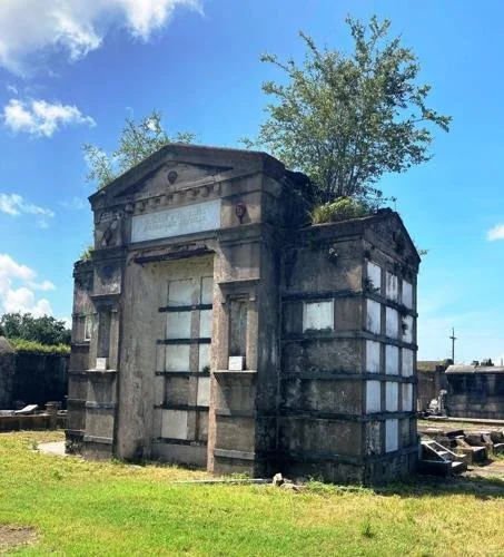
Upper Faubourg New Marigny National Register Historic District

Threats: Demolition, demolition by neglect, architectural degradation

Bounded by St. Claude, St. Bernard, N. Claiborne, and Elysian Fields Avenues. Circa 1830s to 1940s. Known to locals by a variety of names, the New Marigny Historic District was recognized by the State Historic Preservation Office and the National Park Service and was listed in the National Register of Historic Places in 1994. The area took form when developer Bernard de Marigny found it necessary to extend his Faubourg beyond its St. Claude Avenue boundary. Surveyor Joseph Pilie completed the plans for the expansion. The upriver portion is a remarkably intact mix of buildings, most of them dating from the early-to-late 19th century. Creole cottages and shotguns, many reflecting the stylistic changes that swept through the City over various decades, dot the streetscapes.

Hurricane Katrina’s winds and water spared much of the neighborhood, but many of the houses were already in some state of disrepair. There is no design review or regulation of changes to a building’s appearance, which has led to a rash of inappropriate remodeling efforts that undermine the architectural integrity of many buildings. Original wood doors, wood windows and wood siding are being replaced with mass-produced modern building products that are often not suitable for historic structures. An even greater threat is the total loss of buildings through demolition. If the current trend continues, the area’s National Register Historic District designation may be in jeopardy, because it will lose so much of its integrity.

Perseverance Society Hall

Threat: Lack of public awareness and funding for restoration

This former benevolent society hall, with its Mission-style parapet, represents an important part of the City’s cultural and jazz heritage. The Perseverance Society, an antebellum benevolent society founded by Creoles of color, hosted early 20th-century dances, funerals and parades, and played a significant role in the development of jazz. Musicians Buddy Bolden, Joe Oliver, Sidney Bechet, Sam Morgan and others played in the still-intact and now-rare musician’s mezzanine or bandstand, required in a time before amplification. Most of the other African-American benevolent society buildings nearby have been altered beyond recognition, or demolished, the fate of many of the City’s jazz sites. The entire building, now the Holy Aid and Spiritual Comfort Church, was threatened with demolition in Spring 2007 when neighborhood residents complained to the City about the collapsing camelback addition, damaged significantly by Hurricane Katrina’s winds. After many attempts by concerned preservationists and the owner, the City finally granted a permit to remove the compromised addition. Deconstruction of the addition has been completed and the rear of the main structure secured. But funding is still needed to restore the church, which currently lacks electricity for its congregation’s weekly services. Missing weatherboards and windows are among the items that must be repaired.

Downtown Theaters - Saenger, Loew’s State (Palace), Orpheum, Joy, Gallo, Dixie and Clabon theaters

Threat: demolition by neglect, architectural and structural degradation
Update: Sadly, the Gallo Theater was demolished this summer, but the 2007 legislative session resulted in the passage of the Broadway South tax credit program, which has the potential to generate interest in and funding for the remaining historic theaters.

These seven theaters stand as symbols of a time before television, when entertainment for the American public meant going to a vaudeville show or Hollywood movie. They had been underutilized or completely dark for years before Hurricane Katrina inflicted further damage. The Saenger Theatre, designed by architect Emile Weil, flooded and has remained vacant since the storm, as has the Thomas W. Lamb-designed, circa 1926 Loew’s State (Palace), at one time the largest theater in the city. The Canal Street Orpheum, a vaudeville house-turned-movie theater, and Joy, built in the 1940s and wired for television, also flooded and remain closed. The Gallo, Dixie and Clabon theaters have significant structural problems. The roof at the Gallo burned, and heavy timber roof trusses at the Dixie were toppled by the storm. The façade of the Clabon is detaching from the structure. Discount shops operate in some of the Canal Street theater spaces, leading to a further loss of architectural integrity. These theaters would benefit from proposed state legislation – known as Broadway South – to give tax credits to the performing arts industry and to theater owners for renovation. Those breaks, coupled with federal tax incentives for rehabilitating income-producing historic buildings, could spur the redevelopment of Canal Street and surrounding areas.
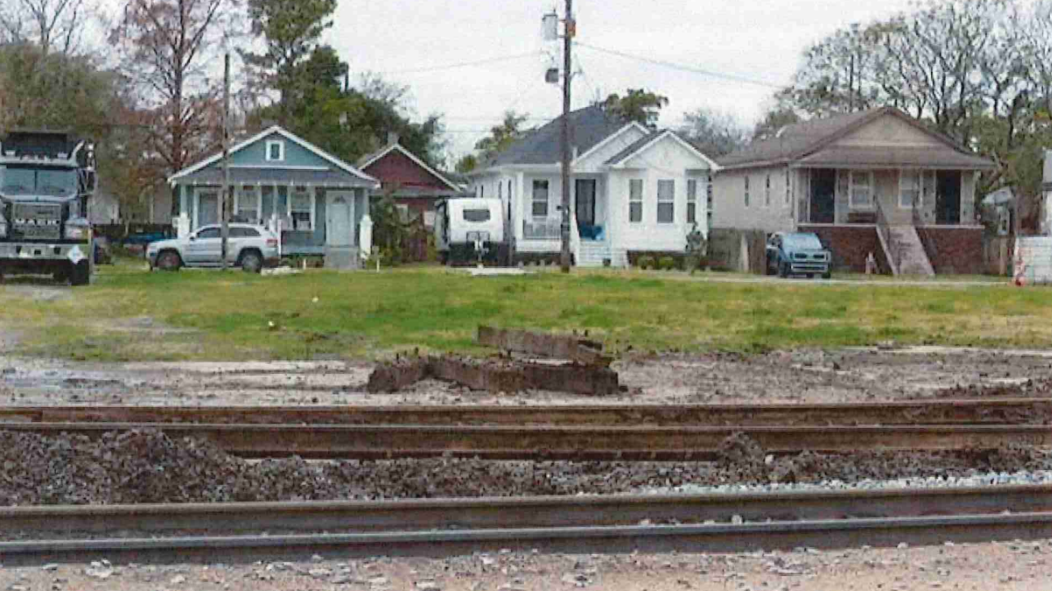
CHARITY HOSPITAL

Threat: neglect, hurricane damage, potential demolition

This massive Art Deco structure has been a beacon for New Orleanians seeking health care since it opened its doors to patients in 1939. The hospital, once one of the premier teaching facilities in the Southern region and the best source of diagnostic medicine and trauma care in the area, flooded during Hurricane Katrina, leaving hundreds of patients and staff stranded. It has not reopened in the two years since and is in desperate need of repairs to its storm-damaged interior. While it may not be feasible to reopen Charity as a hospital, the valuable downtown location has potential alternative uses, such as a senior care facility, specialized medical clinics or even housing for workers in the surrounding medical district. As one of the most important structures designed by the firm Weiss, Dreyfous, Seiferth, the potential loss of Charity Hospital would erase an important artifact of Louisiana’s architectural heritage.

New Orleans Redevelopment Authority’s Realm Properties

Threat: Government inaction

NORA’s REALM (Real Estate Acquisition and Land banking Mechanism) program was created to jump-start private investment in focus areas by making blighted properties readily available to non-profits, individuals, and investors. Its impact, therefore, stood to be profound. Unfortunately, NORA’S efforts have stalled, leaving the REALM properties stuck in limbo, unavailable for purchase and deteriorating rapidly. NORA’s other signature effort, the Blighted Properties Removal Program, allowed private entities to force the sale of legally blighted properties. This effort has been on indefinite hiatus since Katrina. NORA now sits in the odd position of being a perpetrator of blight. The revival of one or both programs could make a huge difference to the recovery of historic and newer neighborhoods alike.

Lakeview School

Threat: Neglect, Hurricane Damage

Taking its name from the surrounding neighborhood, the former Lakeview Public School was designed by local architect E. A. Christy, New Orleans’ most prominent municipal architect for 40 years, who also designed Warren Easton, Mc Main, and Rabouin schools. The school embraced many elements of the emerging Craftsman style, including deep eaves, heavy wooden brackets, and wood shingles on the facades.


The school had been unoccupied for several years, but was badly damaged by the floodwaters that submerged the whole area after the post-Katrina levee failures.

St. Roch Market

Threat: neglect
Update: The St. Roch Market received funding from FEMA for a new metal roof and basic structural repairs. It is an anchor in one of the City’s new “target zones” for redevelopment, raising hopes that it will receive further funding and attention from the City.

Of the dozens of historic public markets which once dotted the city, St. Roch is one of the few still standing. Nestled on a narrow neutral ground in the neighborhood of the same name, the market was built in 1875 as an open-air space, with 24 cast iron columns at the perimeter and a steamboat design scheme. A WPA renovation in the 1930s added such luxuries of the day as refrigeration and plumbing. The building was enclosed after World War II, when the public market system was dissolved, and the building was threatened with demolition. Only public outcry saved it. Post Hurricane Katrina, the market sits vacant, awaiting a return to public use.

Historic Shushan Terminal Complex

Threat: neglect, hurricane damage
Update: Shushan Terminal at the Lakefront Airport has been declared eligible to receive funding from the Federal Emergency Management Agency (FEMA) to repair the damage received from Katrina. The concrete exterior panels from 1964 have been removed, and the exterior may be restored soon. The interior, which remains amazingly intact, is still in need of repair and restoration, particularly the return of the central atrium and the two missing murals (one resides with the State Museum and the other is unaccounted for).

An outstanding and rare local example of the Art Deco period, the Shushan Terminal Complex, now known as New Orleans Lakefront Airport, was designed by the firm of Weiss, Dreyfous and Seiferth and built in 1934. The design motif was continued in the decoration, which included numerous murals by WPA artist Xavier Gonzales. Aside from its architectural significance, the terminal played an important role in aviation history – when built, Shushan was the largest airport in the United States, and Amelia Earhart stayed there prior to her final global flight. During the “golden age of travel,” it served nearly one million passengers.

The damage began with a 1964 renovation, when many of the murals were either covered or removed, and the atrium was enclosed to create office space. Further damage occurred when Hurricane Katrina pummeled the structure. Despite the damage, Shushan remains in good condition and this gem of New Orleans’ Art Deco heritage should be restored.