

1
2
3
4
5
6
7
8
9

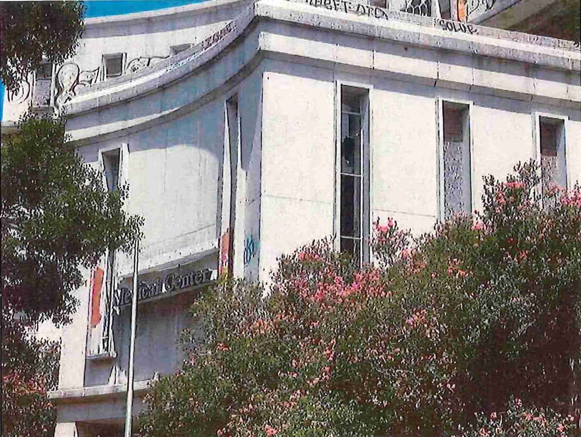
LINDY C. BOGGS MEDICAL CENTER (formally known as MERCY HOSPITAL)
Detriment to its Neighborhood
Severely damaged during Hurricane Katrina and subsequently vacated, this mulb-building former
healthcare insbtubon, originally known as Mercy Hospital, occupies a prominent corner of the Midcity
Historic District. Its campus includes mid-twenbeth century and later structures, which qualify for Federal
Historic Tax credits. Plans to rehabilitate the property into a senior living facility have faltered due to
financial and regulatory issues. The complex—deteriorabng rapidly and marred with graffib—conbnues as
an eyesore. The current owners should rehabilitate the site or sell it.
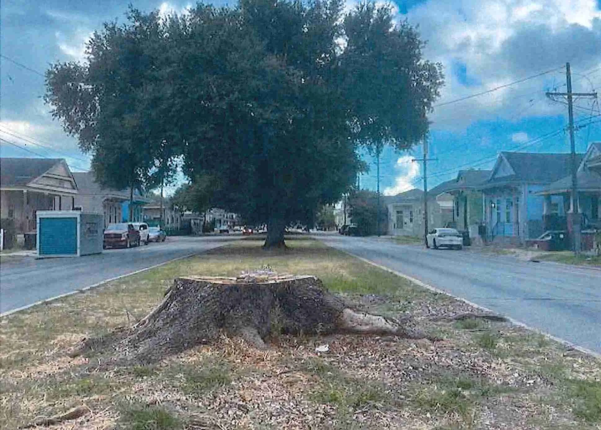
THE NEW ORLEANS’ TREE CANOPY
ORETHA HALEY CASTLE CORRIDOR
LOCATION: Oretha Castle Haley Blvd.
THREAT: DemoliZon by Neglect
For more than fifty years, Dryades Street (now O.C. Haley Blvd.) from downtown to Jackson Avenue
remained an active commercial corridor serving the immigrant community and later the growing African
American population. The end of racial segregation, suburban growth and changes in shopping habits
eventually stripped the corridor of its customers and commerce. O.C. Haley Blvd. was rediscovered and
underwent a remarkable revitalization with a diverse mix of businesses. Nevertheless, several blighted and
vacant commercial and residential properties remain within the corridor, blunting the economic revival
and its sustainability.
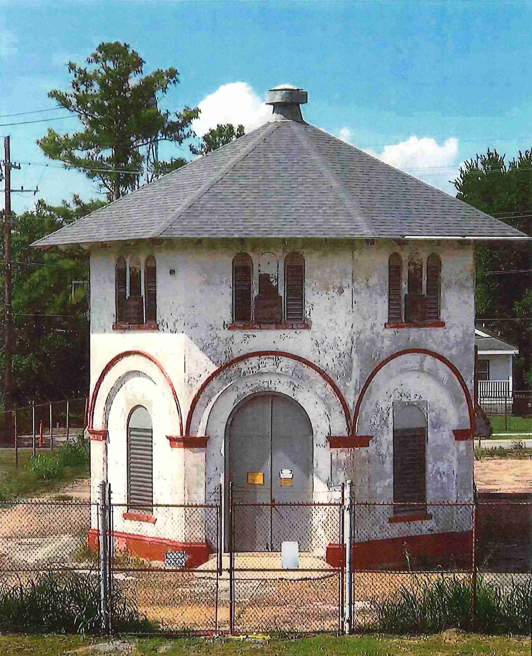
INNER HARBOR NAVIGATIONAL CANAL (IHNC) LOCK REPLACEMENT
Demolition and Future Flood Threat to Orleans & St. Bernard Parishes
In 1903, architect James Armstrong designed nine Mediterranean-style S&WB pumping stations. Station B
faces demolition to make way for a new St. Claude Ave. bridge as part of the Inner Harbor Navigational
Canal (IHNC) Lock Replacement along with the 4500 block of St. Claude Ave. and the historic Bascule
drawbridge. The lock replacement will extend the Mississippi River almost a mile into New Orleans, with
the same type of levee infrastructure that failed catastrophically during the 2005 Federal Flood. This
proposed project is based on outdated economic and transportation data and threatens the safety of the
entire East Bank.
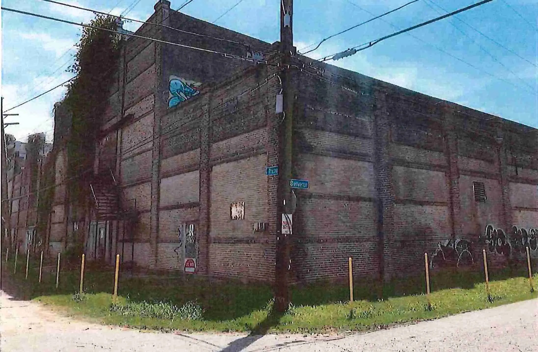
THE SLAUGHTERHOUSE
LOCATION: 301 Alabo Street
THREAT: DemoliZon by Neglect
In post-Civil War New Orleans, manure, blood and offal from numerous slaughterhouses contaminated
water drawn from the Mississippi River, creating a public health hazard. Louisiana responded by mandating
a single slaughterhouse downriver of the city. Butchers sued, claiming the 14th Amendment protected
their livelihoods. The Supreme Court ruled against them, deciding that the 14th Amendment did not apply
to state laws, thus setting the stage for Jim Crow laws. Owned by the Port of New Orleans, the
slaughterhouse buildings, exemplars of 19th-century brickwork, are threatened by neglect.
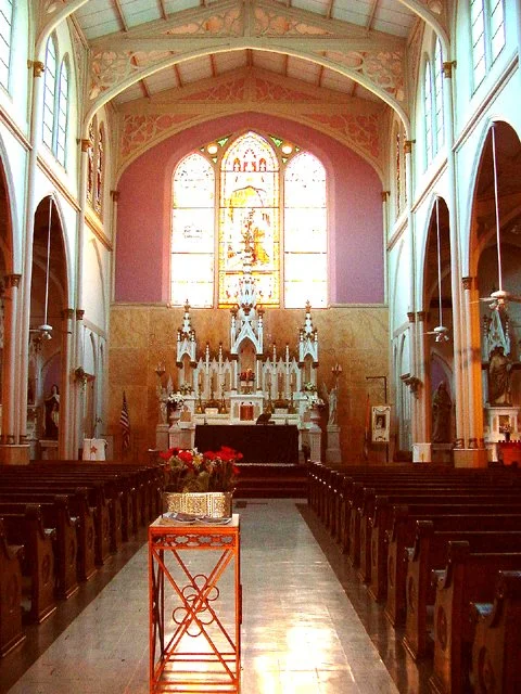
CLOSURE OF CATHOLIC CHURCHES
LOCATION: Citywide
THREAT: Closure of Catholic Churches
As of June 2024, the Archdiocese of New Orleans has closed 10% of its parishes, adding to the previous
merger of 40 parishes and closure of 27 churches since Hurricane Katrina. This shift profoundly impacts the city’s historical and architectural landscape. In Orleans Parish, four notable churches face sale: St. Theresa of Avila (Gothic Revival, 1848), Our Lady Star of the Sea (Byzantine Revival, 1930), St. James the 4 Major and St. Gabriel the Archangel (Midcentury Modern, 1953 and 1955). There is concern, as churches’
intended use is becoming largely obsolete, and they are notoriously difficult to adapt.
BIG GREEN EASY PLAN: PARKS & GREEN SPACES
LOCATION: RecreaZonal and Green Spaces
THREAT: Non-AcZon -- Big Green Easy Plan
New Orleans' smaller green spaces and recreational facilities have long been neglected. The recently
completed comprehensive "Big Green Easy" Master Plan addresses this, proposing to consolidate
management, improve existing parks, and create new ones. It aims to foster community, health, and
sustainability while adapting to water-related challenges. If the Plan becomes law, it could increase the
quality and accessibility of parks and green space. Public support is crucial to move it through the Planning
Commission, Council and Mayor’s offices. It is not law.
LOWER GARDEN DISTRICT
Location: Basin Street Neutral Ground
Threat: Loss of Green Space
The Neighborhood Participation Program (NPP) is not meeting its mandate to effectively involve residents in land use decisions. Meetings lack substance, with consultants gaming the system to meet minimal requirements rather than engaging in meaningful dialogue. Issues include unrealistic meeting times, inaccurate or absent information, questionable reporting practices, and “bait and switch” tactics where final projects differ significantly from the NPP presentations without any further public notice. Advocates are pushing for improvements, including requiring accurate, informative presentations, convenient meetings, official notetaking, video recordings, stricter follow-up mechanisms for changes, and penalties for non-compliance to enhance transparency.
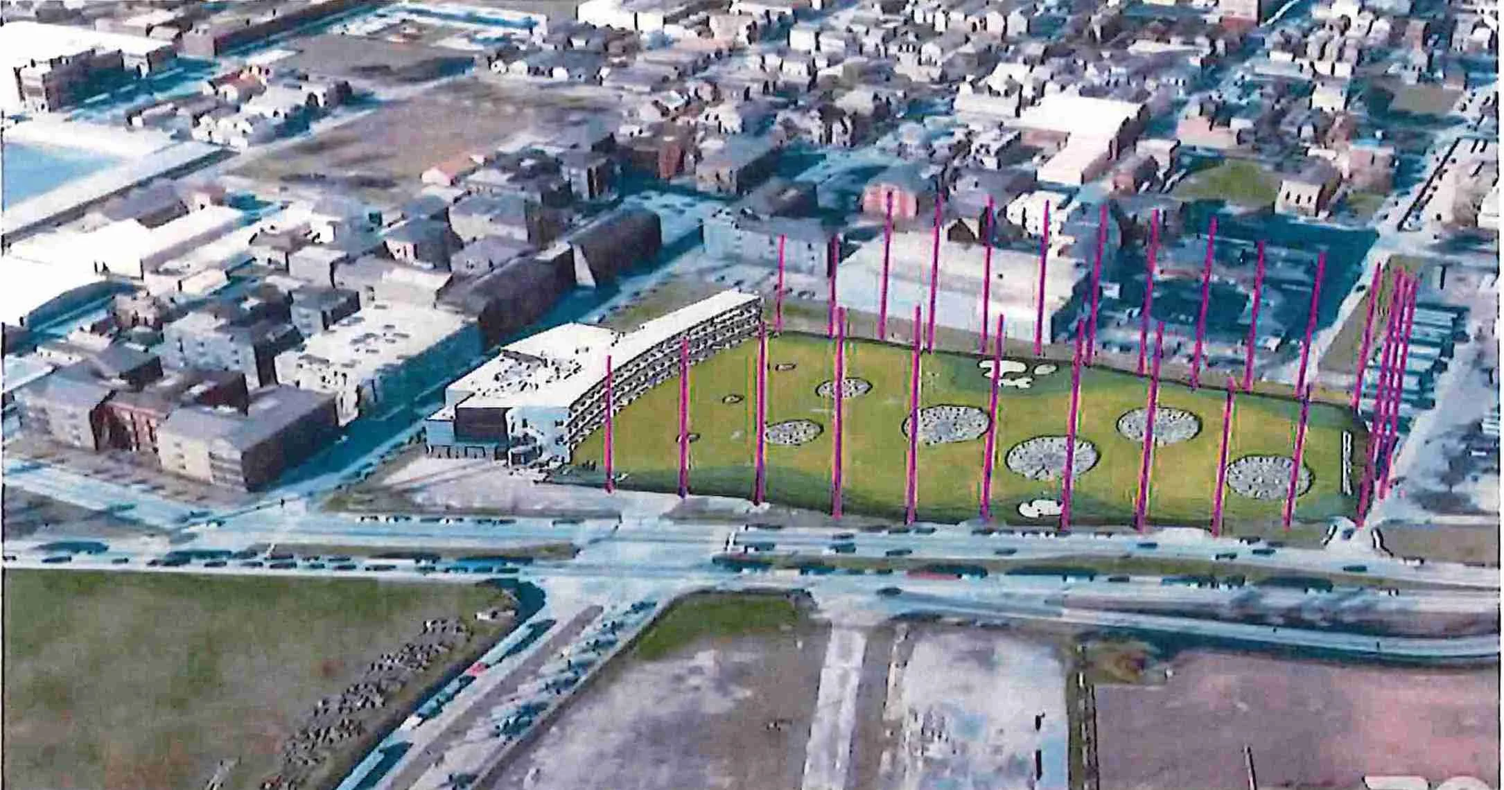
PROPOSED RIVER DISTRICT DEVELOPMENT - TOPGOLF
LOCATION: Lower Garden District
THREAT: Inappropriate, Out-of-Scale Development
The lauded 19th-century Lower Garden District faces a looming threat from the proposed Topgolf facility
within the River District development. Inibally, developers promoted plans for affordable housing and a
grocery store at the site. Residents were blindsided when the City Council passed a text amendment
allowing 175-foot poles, revealing Topgolf's involvement. The lack of transparency and meaningful public
input exemplifies systemic issues in the city's development process. The behemoth structure, visible
citywide, starkly contrasts with the neighboring Nabonal Register Historic District's low-scale residenbal
character. Current zoning processes endanger all of New Orleans' cherished historic neighborhoods.